New Jersey Coastal Atlas Interactive Mapping and Planning Tools
Ocean and Coastal Planning
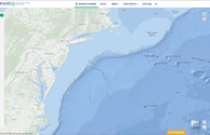
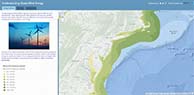
The Mid-Atlantic Ocean Data Portal provides spatial information on ocean resources and human use information such as fishing grounds, recreational areas, shipping lanes, habitat areas, and energy sites, among others in the Mid Atlantic Region. It enables state, federal, and local users and the general public to visualize and analyze data in the Mid Atlantic Region
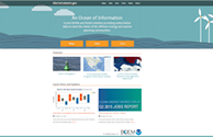
NOAA Office of Coastal Management – Digital Coast is focused on helping communities address coastal issues. This dynamic map and data download website primary focus is on coastal and ocean spatial data distribution.