|
Contact the NJ State Archives
Mailing Address:
NJ State Archives
P.O. Box 307
Trenton, NJ 08625-0307
Office Address:
225 West State Street - 2nd Floor
Trenton, NJ
Contact Information
Email: Feedback@sos.nj.gov
|

Proprietors & Adventurers - Document Images
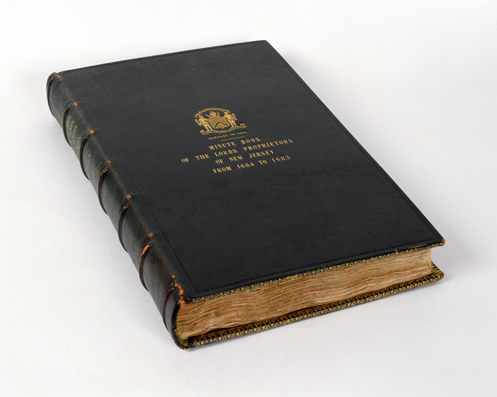
Record Book of Robert Barclay, Proprietary Governor of East
New Jersey, 1684
This volume is the most significant item included in the Christie’s
acquisition, containing transcriptions of land grants, legal cases,
correspondence with officials including William Penn, and a record
of the proceedings of East Jersey’s Lords Proprietors during
1682-84. The volume originally also held the five maps purchased
separately at the auction (see above). Three documents
are shown, as follows:
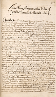
King
Charles II’s patent of 12 March 1664 (top left) granted a vast expanse of the eastern seaboard to his brother James,
Duke of York. The Duke subsequently granted authority for the land
and governance of New Jersey to John, Lord Berkeley and Sir George
Carteret.
New
Jersey’s first colonial governor, Philip Carteret, asserted
ownership of Staten Island based on the language of the 1664 grant
to Berkeley and Carteret (top center). New York’s
governors disagreed, and the question was not fully resolved until
1834.
In
this 1683 “letter” to the colonists (top right),
the king commanded the planters and inhabitants of East New Jersey
to “submit and yield all due Obedience to the Laws and Government”
of the new proprietors.
|
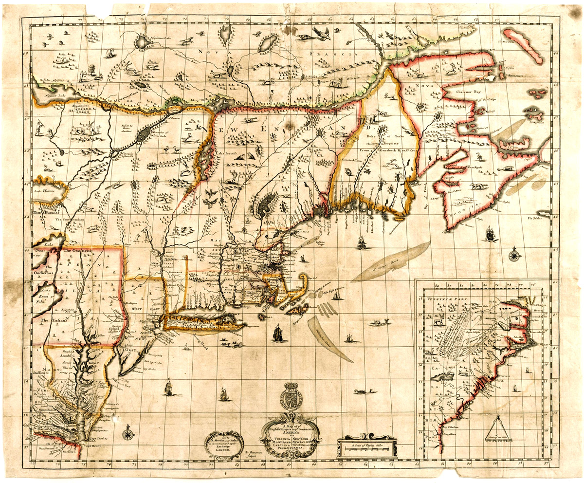
A
Map of ye English Empire in ye Continent of America, circa
1684-85
London
printer Robert Morden published this rare map of Britain’s
American colonies in 1684-85, based on cartographer Richard Daniel’s
rendering of the region. The map shows New Jersey’s east-west
division, but the northern boundary with New York remained unfixed.
|
|
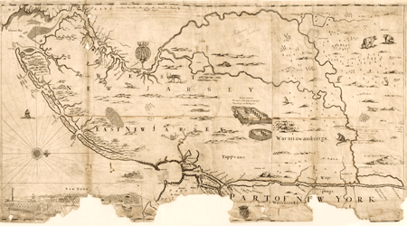
A
Mapp of New Jersey in America, circa 1677
John Seller published the first printed map of New Jersey soon after
its proprietors split the province into eastern and western divisions
in 1676. This extremely rare map erroneously depicts New Jersey
as an island, with the headwaters of the Walkill River connecting
with those of the Delaware.
|
|
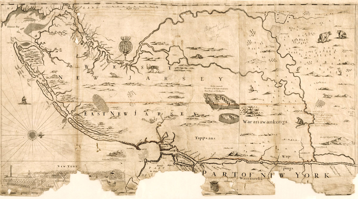
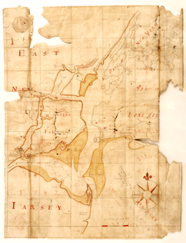
Manuscript Map of New York Harbor, circa 1683
New York Surveyor General Philip Wells’s hand-drawn map of
New York Harbor was originally bound into Governor Barclay’s
record book with documents relating to the claim to Staten Island.
The map, in fact, labels the island as “Being the Proprietors,
1682/3.”
|
|
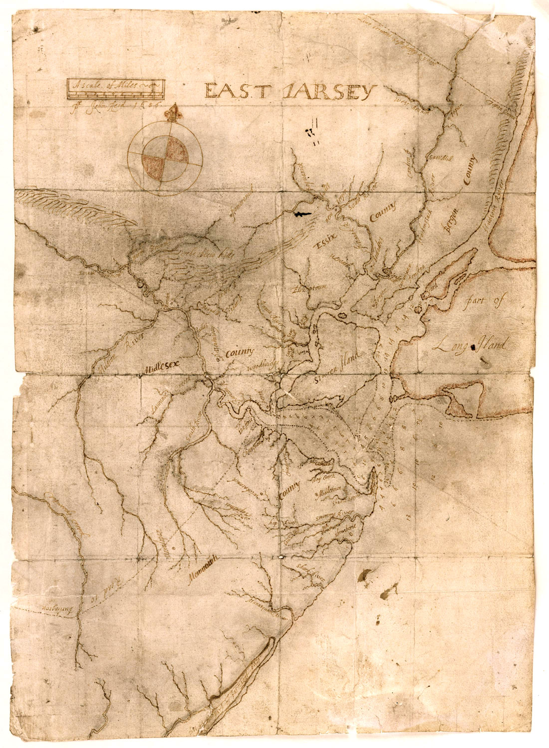
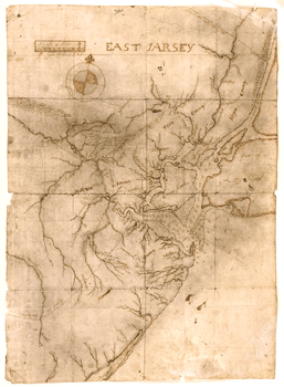
Manuscript
Map of “East Jarsey,” 1686
Acting Surveyor General John Reid rendered the earliest surviving
detailed map of East Jersey’s original counties—Bergen,
Essex, Middlesex, and Monmouth—in 1686. Reid centered the
map on Perth Amboy, the recently established provincial capital
of East Jersey.
|
|
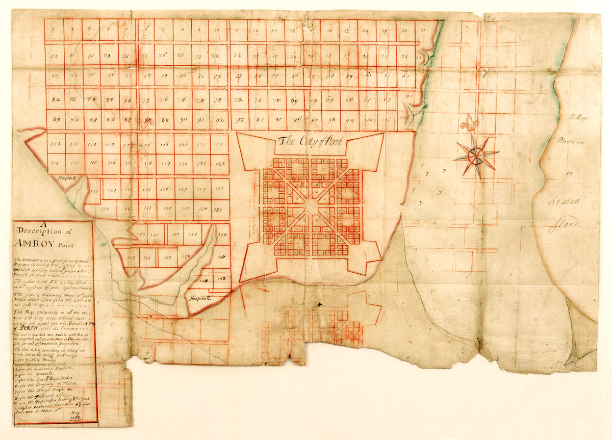
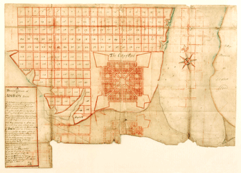
A
Description of Amboy Point, May 1684
In
1682, East Jersey’s proprietors resolved to build a new town
called Perth Amboy, future capital of the province. Surveyor Philip
Wells likely rendered this hand-drawn proposed town plan, which
included nine lots to be used for the common good.
|
|
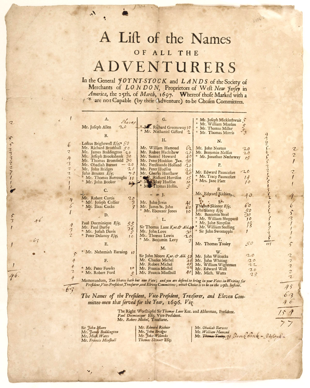
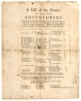
West
Jersey Merchant Adventurers Broadside, 1697
This 1697 broadside lists “adventurers” (i.e., stockholders)
of the Society of Merchants of London, who had invested in land
rights in West New Jersey. It is the only known copy of a printing
likely distributed exclusively to the Society’s members.
|
|
|
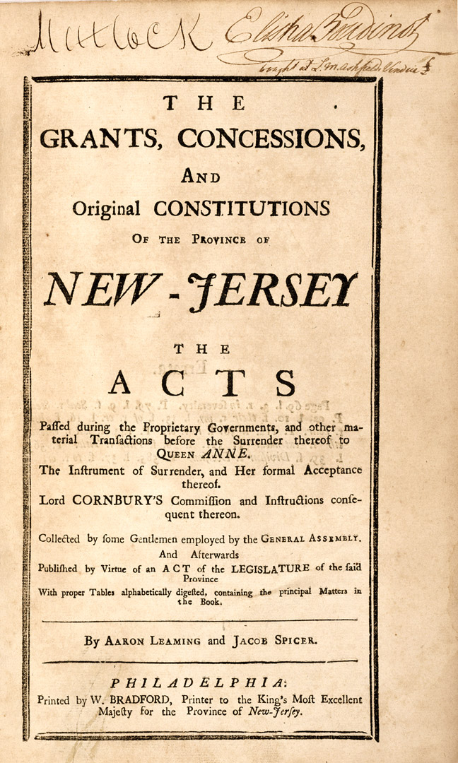
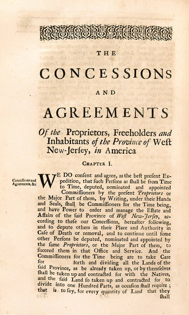
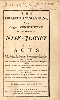
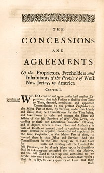
The Grants, Concessions and Original Constitutions of
the Province ..., 1758
Compiled by Aaron Leaming and Jacob Spicer, this compendium contains
the charters and session laws of both East and West Jersey from
the proprietary period (1664-1702). The compilers required nearly
six years for the painstaking work of producing the volume’s
763 pages. Historians consider West Jersey’s “Concessions
and Agreements” of 1677 (right) a prototype American
charter from which sprang the freedoms guaranteed over a century
later in the Bill of Rights.
|
|
|
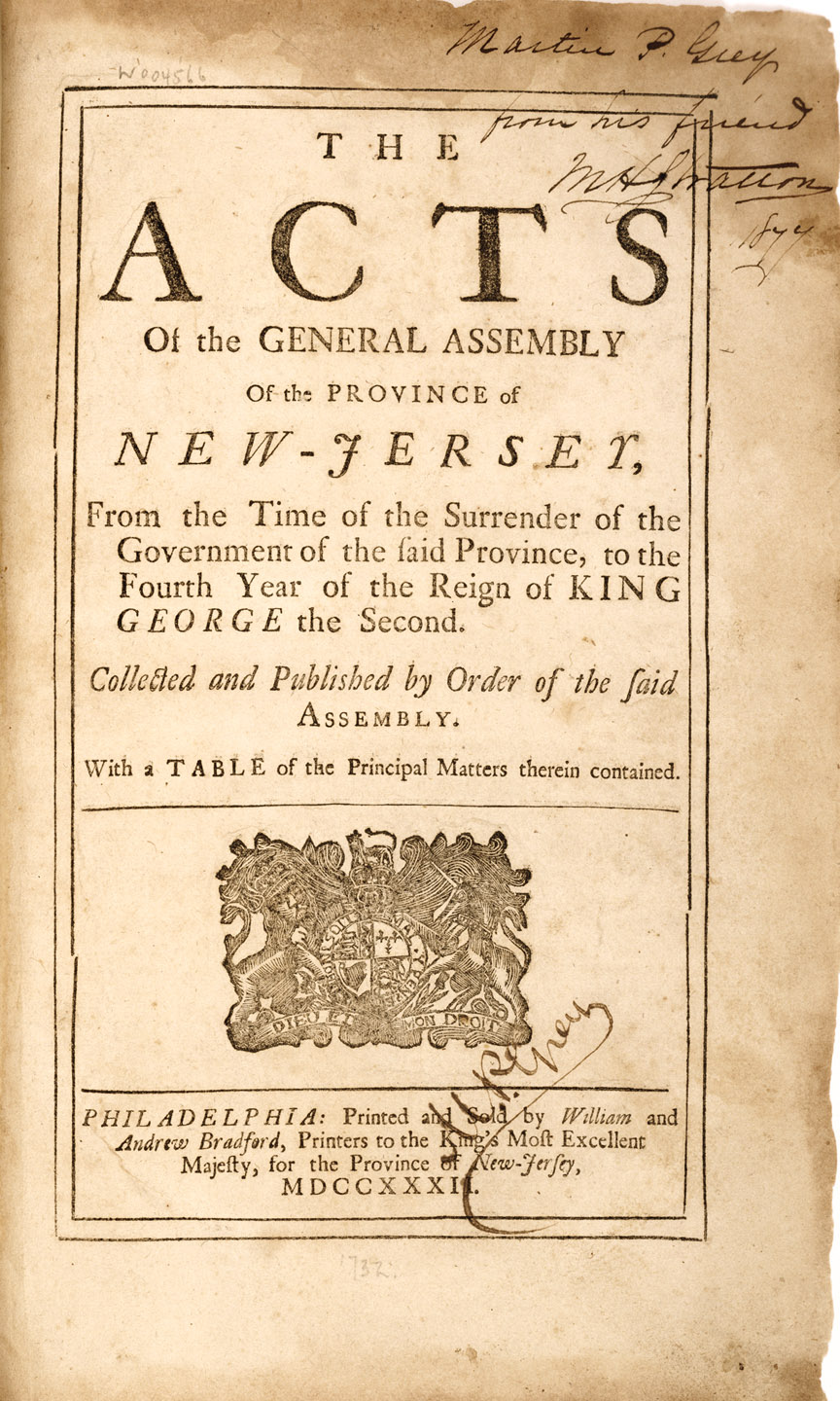
The
Acts of the General Assembly of the Province of New-Jersey ...,
1732
John Kinsey, Speaker of the Provincial Assembly, produced the first
major compendium of New Jersey’s laws (left). Philadelphia
printers William and Andrew Bradford published the work in 1732.
This 1719 law (right) intended to settle a longstanding
dispute over New Jersey’s northern boundary with New York.
The controversy, however, dragged on until 1769 when the crown intervened.
|
|
|
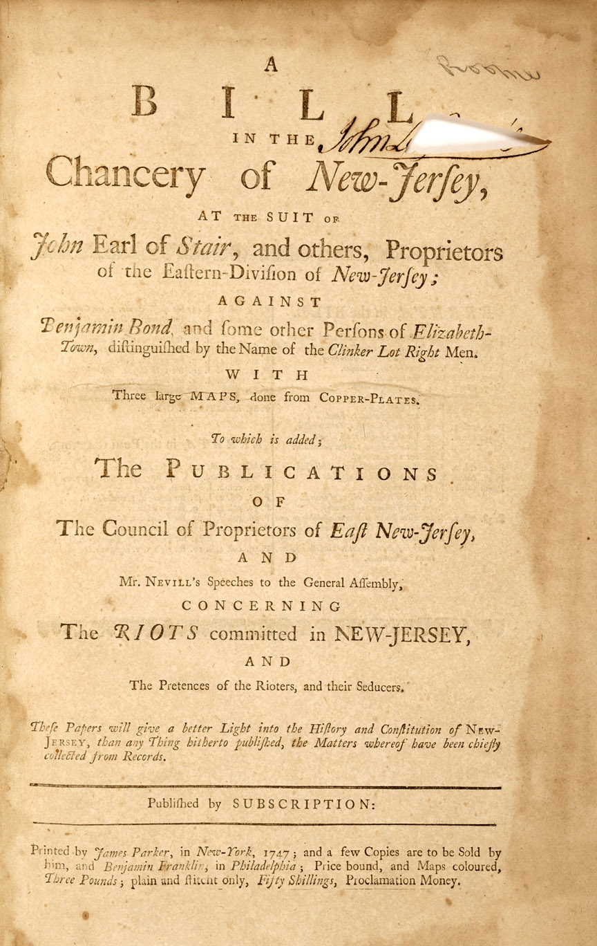
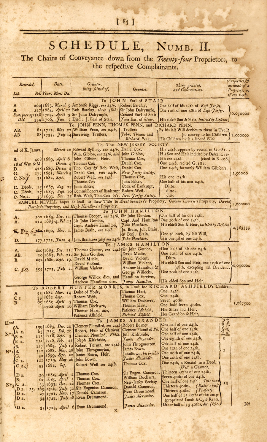
A
Bill in the Chancery of New-Jersey ..., 1747
Disputes in East Jersey between the proprietors and settlers continued
into the 18th century. Controversy over land distribution in Elizabethtown
led to a lawsuit in the Chancery Court. James Parker published the
complaint in 1747, with Benjamin Franklin selling copies in Philadelphia.
Schedule Number II (right) established the chain of title
from the twenty-four purchasers of East Jersey in 1682 to the proprietors
who filed suit.
|
|
|
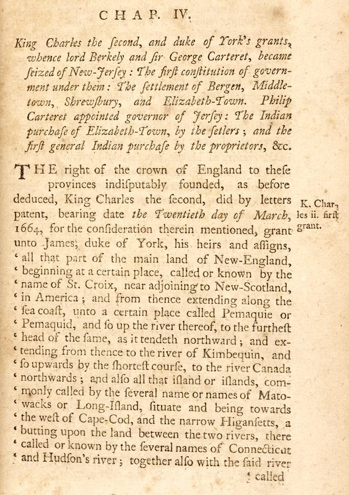
The
History of the Colony of Nova-Caesaria, or New-Jersey ...,
1765
Samuel Smith (1720-1776) authored the first general history of the
colony of New Jersey. The book was printed in Burlington by James
Parker on a press owned by Benjamin Franklin. Chapter IV (right) discusses the royal grant of New Jersey to the Duke of York
and the settlement of East Jersey’s first towns.
|
|