| New Jersey Division of Fish and Wildlife |
|
| July 2, 2002 | Back/Next | ||||||||||||||||||||||
|
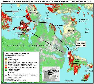
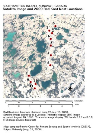
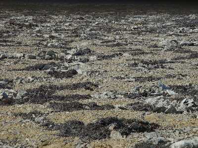
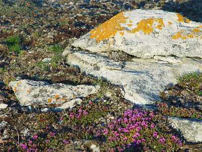
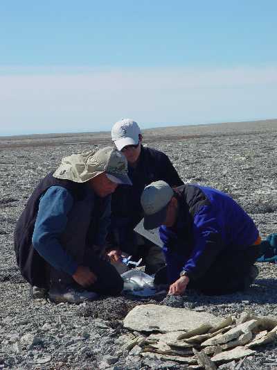
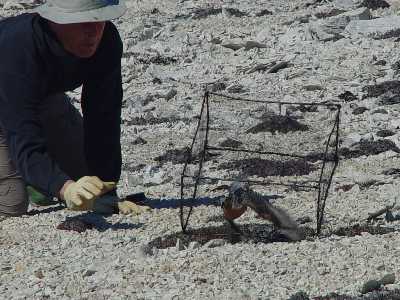
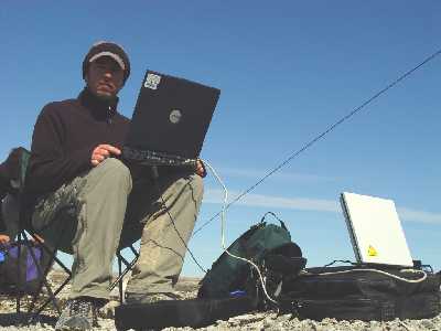
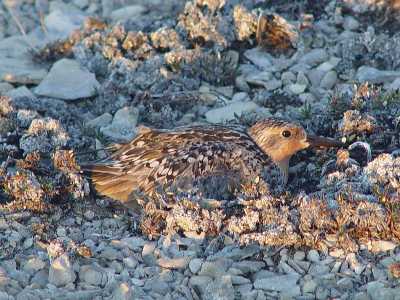
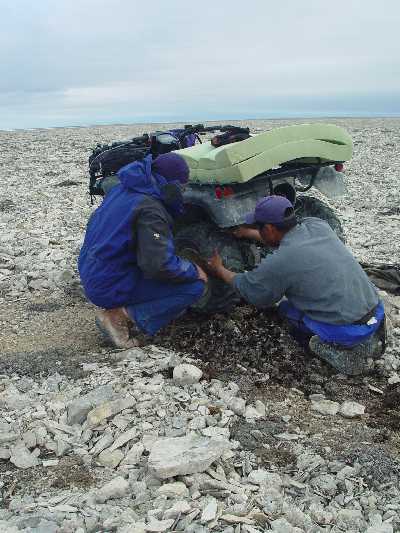
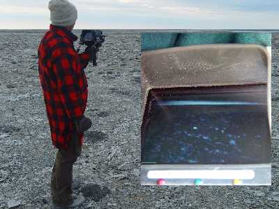
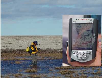
Nearing the end of our trip we began to increase our knot nest count. The location of these nests substantially increased our understanding of knot breeding habitat. When we began our work in the Arctic we literally started at the beginning. First, we had to find red knots by attaching radio transmitters to a small number that we had trapped on the Delaware Bay. Next, we searched for them by airplane throughout the Canadian Arctic. Consequently, Rick produced a map of breeding habitat that was the first comprehensive assessment of breeding habitat of the red knot (see web slide show on this page). Until that early work, no one had a clear idea of where red knots nested in North America. On our 1999 and 2000 expeditions we hiked large areas of the tundra and found nearly all nests on ridges of gravel called eskers. We reasoned that knots nest on eskers because they arrive earlier than other shorebirds and encounter snow, which forces them to nest on the wind blown eskers. Satellite images in mid-June show snow-free eskers in an otherwise snowbound landscape.. This year, as in last, we found no nests on the eskers. We found them this year in similar substrate, glacial deposits of gravel (which Rick called "eskerettes") with scattered patches of arctic dryad (dryas integrifolia). They were not on eskers. We also found nests in mudboil adjacent to the eskerettes. Clearly, our nest habitat characterization was wrong. On the other hand, was it? An interesting debate developed within our team. Each one of us had different opinions about what it meant. We agreed that the birds probably prefer the high ground throughout the landscape because it is usually free of snow and affords a view of the surrounding area. There are risks, however, because predators tend to concentrate on high ground for the superior view they offer. One of the most beautiful places in the tundra is the area surrounding rocks at the top of a esker. Snowy owls, jaegers and arctic fox stop to survey the land from these high points, fertilizing them as they have for thousands of years. This creates a rare and rich soil from which one can enjoy arctic poppy, purple lousewort and many other species. Nesting close to them constitutes a hazard, especially in years of low lemming density like this year. So nesting on lower ground and closer to the wetlands is probably better, but only in years of low snowfall. In our last days our team worked hard to complete our intended objectives. We conducted sweeps in all the areas surveyed in previous years and collected very useful information on other species besides knots. We swept both sides of our 7 km home esker a second time. We banded all the knots and sanderlings we had found. We measured the nests and surrounding habitat of knot, sanderling and golden plover nests. Throughout the trip, Jeff prepared the images and sent reports back to home via satellite phone. We were also able to begin radio tracking of adults from two nests. Mandy, Humphrey, and I followed these birds within their territories, losing them in the direction of the coastal wetlands. We need to conduct further telemetry, but we now suspect that in late June, before the young have hatched and insects number are low in the interior, the birds fly to the coast during their non-incubation period. It may be one reason why knots incubate in shifts up to 24 hours, longer than any other birds. Our days are arduous and long, sometimes walking 25 km in one day. It even got tougher when we had a serious flat on the ATV. Johnny tried to fix the tire by stuffing it with dryas, but the ATV was rendered unusable. Despite all of this, on two nights, Bruce, Mark and Rick still had enough energy to go out and test a thermal sensing device loaned to us by Scott Health and Safety Corporation. We wanted to see if the device could find nesting birds in the early morning when the tundra had lost its daytime heat and the birds would stand out plainly. The test was a limited success. At about 4:00 am the knots stood out clearly at 30 yards. With a telephoto lens, it would be more useful on the ground. A more sensitive instrument also might be useful from the air. Throughout the trip, Rick improved our mapping abilities. He carried a pocket pc with him everywhere in the field and recorded location of sweeps, animals, nests on an on-screen map. In addition, he verified our satellite imagery so that we now have a beautiful image of all of our work, from point count surveys and radio telemetry observations to nest and animal observations. |
|