
NJ Squirrel Hunting Areas Boundary Descriptions
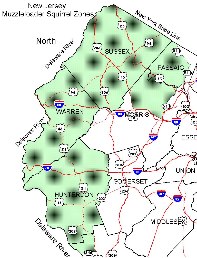
NORTH ZONE
That portion of Passaic, Mercer, Hunterdon, Warren, Morris, and Sussex counties lying within a continuous line beginning at the intersection of Rt. 513 and the New York State line; then south along Rt. 513 to its intersection with Rt. 511; then south along Rt. 511 to its intersection with Rt. 46; then west along Rt. 46 to its intersection with Rt. 80; then west along Rt. 80 to its intersection with Rt. 15; then north along Rt. 15 to its intersection with the Morris-Sussex County line; then south along the Morris-Sussex County line to the Warren County line; then southwest along the Morris-Warren County line to the Hunterdon County line; then southeast along the Morris-Hunterdon County line to the Somerset County line; then south along the Somerset-Hunterdon County line to its intersection with the Mercer County line; then west and south along the Hunterdon-Mercer County line to its intersection with Rt. 31; then south along Rt. 31 to its intersection with Rt. 546; then west along Rt. 546 to the Delaware River; then north along the east bank of the Delaware River to the New York State Line; then east along the New York State Line to the point of beginning at Lakeside.
Map
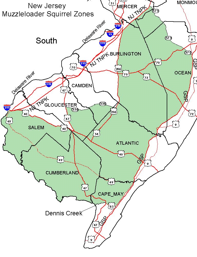
SOUTH ZONE
That portion of Salem, Gloucester, Camden, Burlington, Mercer, Monmouth, Ocean, Atlantic, Cape May, and Cumberland counties lying within a continuous line beginning at the intersection of Rt. 295 and the Delaware River; then east along Rt. 295 to its intersection with the New Jersey Turnpike; then east along the New Jersey Turnpike to its intersection with Rt. 40; then east along Rt. 40 to its intersection with Rt. 47; then north along Rt. 47 to its intersection with Rt. 536; then east along Rt. 536 to its intersection with Rt. 206; then north along Rt. 206 to its intersection with the New Jersey Turnpike; then northeast along the New Jersey Turnpike to its intersection with Rt. 571; then southeast along Rt. 571 to its intersection with the Garden State Parkway; then south along the Garden State Parkway to its intersection with the southern bank of the Great Egg Harbor Bay in Cape May County; then west along the southern bank of the Great Egg Harbor Bay to its intersection with North Shore Road (Rt. 9); then south along Rt. 9 to its intersection with Rt. 83; then west along Rt. 83 to its intersection with Rt. 47; then north along Rt. 47 to its intersection with Dennis Creek; then south along the west bank of Dennis Creek to its intersection with Delaware Bay; then northwest along the east shore of Delaware Bay and the Delaware River to the point of beginning.
Map