Digital Geodata Series
DGS01-1 ArcView 3.x Extension for 3D Well-Field Generation and Visualization
 
 dgs01-1.zip (470KB) dgs01-1.zip (470KB)
DGS01-1 includes the ArcView 3.x extension 3DWellField.avx. This extension
is used to generate and visualize three-dimensional (3D) shapefiles
of well-field well-construction parts, inclined planes, packer-test
results, borehole fractures, and geophysical logs based on borehole
and rock-core records. The extension is dependent on the ESRI ArcView
3D Analyst extension. Data required for shapefile generation can be
compiled outside of ArcView, then joined with a two-dimensional (2D) coverage
of well locations in ArcView to generate and visualize the well-field components.
The extension generates 3D multi-part shapefiles of well parts for cased,
open, screened, and packer-tested intervals, 3D plane shapefiles of
inclined stratigraphic contacts, water-bearing zones, and borehole
fractures, and 3D polyline shapefiles of geophysical borehole logs. The extension
also provides a tool for calculating the depth(s) of intersection for an
inclined plane of known location and orientation for each well in the well
field. Instructions for loading the extension, organizing the input
data, and executing the extension functions are detailed within the User's
Guide along with sample output.
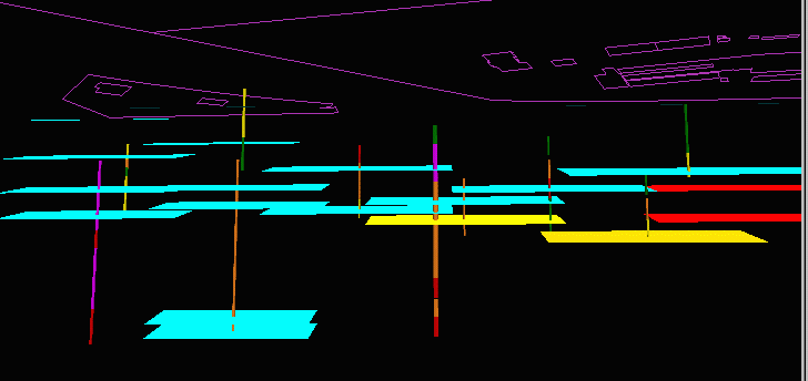
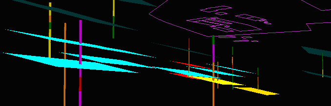
Sample images of a 3D well field generated using
3DWellField.avx.
Click on an image for more detail.
3D features include a set of control lines
(purple) at the surface
corresponding to property boundaries and infrastructure,
bed-parallel water-bearing zones (lt. blue, red, and orange
planes oriented at dip azimuth 133 degrees, inclination 17 degrees,
strike length 200 ft., and a strike-to-dip aspect of 2:1), and multicolored
packer-test shapes covering parts of many wells (20-ft. sampled
intervals).
|