Department of Environmental Protection

New Jersey State Park Service

NJ State Park Service LogoNJ State Park Service Logo

Wharton State Forest Visiting Vehicle Use Map

Update - April 9, 2024: The public comment period for the proposed Wharton State Forest Visting Vehicle Use Map closed on Monday, April 8, 2024, at 11:59 p.m. The Department of Environmental Protection is in the process of reviewing the comments submitted. The next update is expected in the Fall.

Building upon its commitment to robust public engagement, the New Jersey Department of Environmental Protection is now accepting online comments from the public for the proposed Wharton State Forest Visiting Vehicle Use Map. The public comment period runs for 45 days until Saturday, March 9. *We have extended the public comment period to 11:59 pm on Monday, April 8, 2024

The proposed map, released on Jan. 24, designates legal routes for street-legal vehicle usage, while protecting culturally and ecologically sensitive areas. Routes included on the map will allow for focused routine maintenance by the State Park Service, enhancing the visitor experience and access for emergency response personnel.

Development of the proposed Wharton Visiting Vehicle Use Map was guided by input provided by stakeholders in 1,610 surveys submitted online, by email, and through traditional mail between Sept. 28 and Nov. 11, 2022. Additionally, DEP data on endangered and nongame species, wetlands, historic resources, rare plants and ecological habitats were taken into consideration in developing the proposed Wharton Visiting Vehicle Use Map.

“People visit Wharton for many different reasons, among them hiking, canoeing, camping, enjoying nature, fishing, hunting, horseback riding and driving along the forest’s many miles of sand routes,” said Commissioner Shawn. M LaTourette. “A Visiting Vehicle Use Map with clearly defined driving routes and recreational access opportunities is long overdue. This map will become an important tool in ensuring responsible enjoyment of this natural and recreational treasure as well as a valuable resource guide to the many recreational opportunities Wharton offers.”

Read the DEP's Jan. 24 press release.

Video message from Environmental Protection Commissioner
Shawn M. LaTourette
Learn more
Timeline: Wharton State Forest Visiting Vehicle Use Map

Since 2021, the DEP has been hard at work meeting with stakeholders and municipal government officials, along with reviewing internal data and public comments to inform the decision-making process around the proposed Wharton State Forest Visiting Vehicle Use Map. Below is a snapshot of how we reached this point today.

2021

April 21, 2021

On April 21, 2021, New Jersey Department of Environmental Protection Commissioner Shawn M. LaTourette announced in an NJ Spotlight article that the DEP would be proposing a new map showing where vehicles can and cannot legally drive in Wharton State Forest.

2022

Sept. 27, 2022

On Sept. 27, 2022, the DEP hosted a virtual online meeting which introduced the Wharton State Forest Visitor and Vehicle Use Survey to learn how and where park visitors recreate in Wharton State Forest. The survey included multiple choice questions, the opportunity to submit written comment and the ability to mark up a map indicating locations of interest. Survey responses were accepted from Sept. 28 through Nov. 11, 2022. The goal of this process was to develop a plan for motorized vehicle access with the expressed intent of ensuring public safety and protection of natural, cultural and historic resources in the state forest.

2022

Nov. & Dec. 2022

Mayors from the ten municipalities adjacent to Wharton State Forest were given the opportunity to speak with the DEP about the Wharton State Forest Visitor and Vehicle Use Survey and the goal to develop a plan for motorized vehicle access.

2023

Feb. 8, 2023

On Feb. 8, 2023, the DEP presented the results of the Wharton State Forest Visitor and Vehicle Use Survey during a second virtual online meeting. The presentation was followed by a two-hour public comment period. Those who were unable to make a public comment during the meeting were also able to submit comments online.

2023

Feb. - Dec. 2023

Throughout 2023, the DEP reviewed responses and comments submitted as part of the Wharton State Forest Visitor and Vehicle Use Survey and from the Feb. 8, 2023, online meeting. In addition, the DEP evaluated data from DEP’s Fish and Wildlife program, the DEP’s Historic Preservation Office, and the DEP’s Office of Natural Lands Management. This information was brought together along with the Pinelands Commission adopted USGS topographic map of Wharton State Forest to develop the proposed Wharton Visiting Vehicle Use Map.

The DEP engaged with interested stakeholders including Open Trails New Jersey, Tread Lightly, the Pinelands Commission, the Pinelands Preservation Alliance and the NJ Conservation Foundation.

2023

Dec. 21, 2023

On Dec. 21, 2023, the DEP announced that it would hold an open house for the proposed Wharton State Forest Visiting Vehicle Use Map on Jan. 24, 2024 at the Batsto Visitor Center. It was also announced that the same information presented at the open house would be available online for public comment.

2024

Jan. 2024

Mayors from the ten municipalities adjacent to Wharton State Forest were given the opportunity to speak with the DEP about the proposed Wharton Visiting Vehicle Use Map prior to the Jan. 24 open house.

2024

Jan. 24, 2024

On Jan. 24, 2024, the Wharton Visiting Vehicle Use Map was presented to the public in an open house format at the Batsto Visitor Center from noon – 7 p.m. Attendees of the open house were able to review posters and maps depicting information that contributed to the development of the proposed Wharton Visiting Vehicle Use Map, ask DEP staff questions about the draft map and submit formal written comments. The same information from the open house was also released at noon on Jan. 24 online at njparksandforests.org/wharton/ and interested stakeholders can submit comments through 11:59 pm on Monday, April 8, 2024.

Data: Wharton State Forest Visiting and Vehicle Use Map

The following series of posters and maps outlines the process the DEP went through in developing the Wharton Visiting Vehicle Use Map. Please review these items from first through last as information is intended to be viewed sequentially. The proposed Wharton Visiting Vehicle Use Map can be viewed in "Poster & Map 9: Proposed Wharton Visiting Vehicle Use Map."

The same posters and maps displayed on this webpage were on display for public viewing on Jan. 24 from noon to 7 p.m. at an open house at the Batsto Visitor Center.

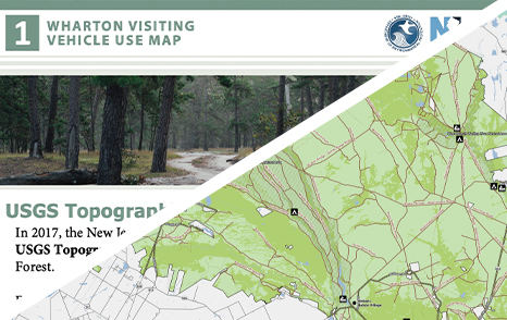
Poster & Map 1: USGS Topographic Maps

In 2017, the New Jersey Pinelands Commission passed a resolution that adopted USGS Topographic Maps which labeled routes within Wharton State Forest, however some data was not accurate. This poster and map explains these nuances.

Download
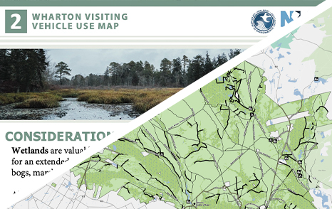
Poster & Map 2: Consideration of Wetlandsg
Poster & Map 2: Consideration of Wetlands

The Kirkwood-Cohansey Aquifer beneath the Pine Barrens provide drinking water for residents of southern New Jersey. This poster and map explains the importance of wetlands shows what routes on the USGS Topographic Maps intersect with wetlands.

Download
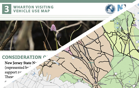
Poster & Map 3: Consideration of Natural Lands Management Data

The NJDEP's Office of Natural Lands Management and Endangered and Nongame Species Program supplied data that shows areas that support rare and endangered plants and animals. This poster and map explains what Natural Areas and Natural Heritage Priority Sites are and shows what routes on the USGS Topographic Maps intersect with these areas.

Download

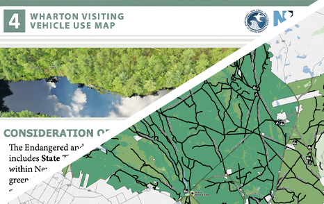
Poster & Map 4: Consideration of Endangered and Nongame Species

Endangered and Nongame Species data outlines habitat for animals which includes State Threatened, State Endangered or Federally Listed Species Habitat within New Jersey. This poster and map explains this data and shows what routes on the USGS Topographic Maps intersect with habitat of endangered and nongame species.

Download
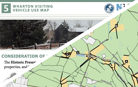
Poster & Map 5: Consideration of Historic Preservation Office Data

Historic preservation data provided by the NJDEP Historic Preservation Office includes archaeological sites, historic properties and historic districts within Wharton State Forest. This poster and map explains this data and shows what routes on the USGS Topographic Maps intersect with historic resources.

Download
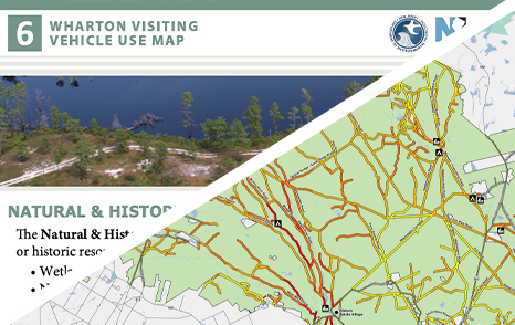
Poster & Map 6: Natural & Historic Combined Resources

The Natural & Historic Combined Resources poster and map depicts how many natural and/or historic resource layers overlap a route segment - this analysis included wetlands, Historic Preservation Office data, Natural Areas, Natural Heritage Priority Sites and endangered and nongame species.

Download

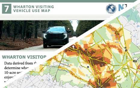
Poster & Map 7: Wharton Visitor and Vehicle Use Survey

Data derived from the Wharton Visitor and Vehicle Use Survey was used to determine where visitors enjoy driving within the forest. This data is displayed graphically on poster and map seven.

Download
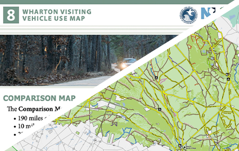
Poster & Map 8: Comparison Map

The comparison poster and map details proposed routes, proposed routes not included on the USGS Topographic Maps, routes removed for natural and historic resource concerns and misidentified routes on the USGS Topographic Maps.

Download
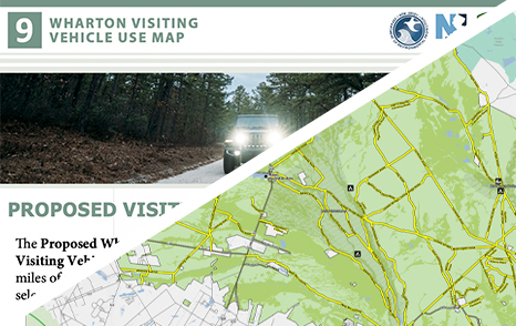
Poster & Map 9: Proposed Wharton Visiting Vehicle Use Map

The proposed Wharton State Forest Visiting Vehicle Use Map consists of 200 miles of routes for vehicle use.

Download
Frequently Asked Questions: Wharton State Forest Visiting and Vehicle Use Map

After reviewing the data used to create the proposed Wharton Visiting Vehicle Use Map, please read through the frequently asked questions below which will help clarify any questions that you may have regarding the proposed map, enforcement of the proposed map, authority of the State Park Service to implement the map, among other topics.

A: The Wharton Visiting Vehicle Use Map clearly delineates legal routes through Wharton State Forest, on which a licensed driver can drive their street legal, registered and insured vehicle.

Motor vehicle regulations remain unchanged. ATVs, side-by-sides, non-street-legal enduros, vehicles with tires larger than 40 inches in overall diameter and other unregistered, and therefore illegal, off-road type vehicles are not permitted in any area of the state forest.

Public comment on the proposed Wharton Visiting Vehicle Use Map is open through 11:59 pm on Monday, April 8, 2024. DEP staff will review the comments received and determine if further changes are needed to the Wharton Visiting Vehicle Use Map. DEP anticipates releasing the final Wharton Visiting Vehicle Use Map in 2024.

A: Please refer to our timeline section of this page.

A: The Wharton Visiting Vehicle Use Map will clearly delineate legal routes for driving through Wharton State Forest. Having a well-defined network of routes available for vehicular use allows for protection of natural and historic resources and routine maintenance, resulting in safe exploration of the forest, efficient enforcement and most importantly, visitor safety.

A: At this time there are no plans for a permit system to be associated with the Wharton Visiting Vehicle Use Map. The DEP will continue to evaluate the need for a permit system.

A: During the development of the Wharton Visiting Vehicle Use Map, the DEP used the USGS Topographic Maps as the baseline for routes through the forest. These maps labeled 510 miles of routes within Wharton State Forest. Further review by the DEP determined that 120 miles of routes on the USGS Topographic Maps were not routes at all; they were boundary lines, fire control lines, or nonexistent because no routes could be identified on the ground.

Misidentified routes are shown as brown-dashed lines on Map 1 - USGS Topographic Maps. The remaining 390 miles of routes considered for vehicle use are shown as solid brown lines.

A: 200 miles of routes are proposed to remain open for use by street legal, registered and insured vehicles operated by a licensed driver.

A: For hiking, biking and horseback riding visitors should refer to the Wharton State Forest Trail Map and routes available to vehicles, as depicted on the Wharton Visiting Vehicle Use Map, are also available for hiking, biking and horseback riding.

A: No. ATVs and UTVs/side-by-sides are not permitted on State Park Service property pursuant to (N.J.A.C. 7:2-3.2(e)).

A: No. UTV’s/side-by-sides are not permitted in state parks or forests. The State Park Service’s Code (N.J.A.C. 7:2-3.2(e)) states that “a person shall not operate or permit the operation on or over lands or in or on waters under the jurisdiction of the State Park Service of a motorized vehicle likely to cause damage or injury to persons, wildlife, or property within the jurisdiction of the State Park Service.” A side-by-side falls within this category of motorized vehicle.

A: The State Park Service has the authority to regulate vehicle travel through state parks and forests pursuant to the following provisions in the State Park Service Code:

  • N.J.A.C. 7:2-2.3 Limitation or closing of land and water use
    The Director of the Division of Parks and Forestry or the Assistant Director of the Division for the State Park Service may limit or close to the public use, specific areas, lands, waters and facilities under its jurisdiction and control as part of a State Park whenever such action is deemed necessary for proper management and operation and/or in the best interest of health, safety and the general welfare of the public.
  • N.J.A.C. 7:2-3.4 Restriction on operation of motor vehicles
    (a) A person shall not operate any motor vehicle on or over any lands under the jurisdiction of the State Park Service except on established public roads or in designated parking areas unless allowed otherwise by posted signs or this subchapter.
    (b) A person shall not operate a motor vehicle at any time on or over any road designated closed by signs or barriers.
    (c) A person shall not operate a motor vehicle on or over any cultivated or planted area, transmission line, survey line or in the woods, swamps, bogs, wetlands or fields unless a permit for said specific activity and location is issued by the Superintendent or designee.
    (d) A person shall not operate an off-road vehicle on or over the lands and waters under the jurisdiction of the State Park Service at any time except that, when an area is so designated by the State Park Service, permits may be granted for organized "special events" to operate on a pre-established course under prescribed conditions.
    (e) A person or organization shall not conduct a motor vehicle race, rally, exhibition or demonstration of any type on State Park Service lands and waters without a permit issued by the Superintendent or designee.

A: The DEP’s Historic Preservation Office has a backlog of data that is yet to be digitized and thus does not appear on the “Consideration of Historic Preservation Office Data” map.

A: Enduro events are permitted through authorized Special Use Permits. The Wharton Visiting Vehicle Use Map will not change the present Enduro Management Plan and the State Park Service policy regarding Organized Competitive and Recreational Motorized Vehicle Events and Activities.

A: The Wharton Visiting Vehicle Use Map will clearly outline where vehicles can drive in Wharton State Forest. Visitors driving vehicles on undesignated routes will be cited accordingly.

Fines for illegal off-road vehicle use and damages start at $250 to $500 for a first offense, $500 to $1,000 for a second offense, and a minimum of $1,000 for a third or subsequent offense. If a violation results in damage to or destruction of natural resources, an additional fine of five times the cost of the damage may be assessed.

A: Park visitors who encounter illegal off-road vehicle activity may call 1-877-WARNDEP (1-877-927-6337). Additionally, there is a Warn DEP iPhone and Android application that allows visitors to report environmental abuses, including off-road vehicles. For information on how to download the application, visit: nj.gov/dep/warndep.htm

A: The Wharton Visiting Vehicle Use Map supports an improved visitor experience, making it clearer for first time visitors how to access popular points of interest throughout Wharton State Forest such as kayak launches, historic sites and trailheads. The map supports prioritizing route maintenance needs and ultimately improves public safety and enhances law enforcement activities. Ninety-eight percent of the 124,000-acre state forest is less than one mile from a paved or sand route as detailed on the proposed Wharton Visiting Vehicle Use Map.

A: Yes, emergency responders will still be able to access all areas of the forest during an emergency. Focused maintenance and repairs will facilitate quicker response time, access and safety for first responders.

A: Submit an online comment on this page.

A: Yes, the final map will include additional information, such as trailheads or other points of interest throughout the forest which will help guide visitors through the forest. Changes may also be made to proposed routes based on comments received during the public comment period.

A: Yes! The final Wharton Visiting Vehicle Use Map will be released as a georeferenced PDF which can be imported to apps such as Avenza that will show you where you are on the map. The map will need to be downloaded prior to driving through Wharton State Forest as many areas of the forest have poor cell coverage.

A: Signs, usage markers, gates and barricades will all be used to help supplement the Wharton Visiting Vehicle Use Map. It is the motor vehicle operator’s responsibility to know where they are and the usage rules of the route they are on at all times. State Park Police will also utilize the Wharton Visiting Vehicle Use Map to assist in enforcement of the State Park Service Code.

A: A Fish and Wildlife permit to shoot or hunt from a stationary vehicle is valid for use only in those routes that are authorized for vehicle use on the Wharton Visiting Vehicle Use Map. Visitors driving vehicles on undesignated routes will be cited accordingly.

A: Public comment on the proposed Wharton Visiting Vehicle Use Map is open through Saturday, March 9, 2024. DEP staff will review the comments received and determine if further changes are needed to the Wharton Visiting Vehicle Use Map. DEP anticipates releasing the final Wharton Visiting Vehicle Use Map in 2024.

A: N.J.A.C. 7:2 – Subchapter 3. Motorized Vehicles

N.J.A.C. 7:2-3.1 Identification and license
(a) A person shall not operate any motor vehicle on lands under the jurisdiction of the State Park Service or on established roads under the control of the State Park Service unless the vehicle is properly licensed and registered before it is operated.
(b) A person shall not operate any motor vehicle on lands under the jurisdiction of the State Park Service unless the operator of the motor vehicle shall have in his or her possession a valid operator's license and other documentation required by the New Jersey Division of Motor Vehicles.

N.J.A.C. 7:2-3.2 Unauthorized motor vehicle use
(a) A person shall not operate any motorized vehicle which does not require licensing and registration by the New Jersey Division of Motor Vehicles, on lands and waters under the jurisdiction of the State Park Service unless a permit for operation of said motorized vehicle is issued by the Director of the Division of Parks and Forestry or the Assistant Director of the Division for the State Park Service.
(b) Any permit granted pursuant to (a) above shall include designated hours and specific locations for operation.
(c) A person shall not operate a motor vehicle upon the ice-covered waters under the jurisdiction of the State Park Service at any time except for the operation of snowmobiles on routes designated by the State Park Service.
(d) A person shall not operate a motor vehicle upon State Park Service property while knowingly allowing any person riding upon any bicycle, coaster, skates, sled, skis, sliding device or toy vehicle to attach the same or himself to the motor vehicle.
(e) Except in accordance with N.J.A.C. 7:2-3.4(d), a person shall not operate or permit the operation on or over lands or in or on waters under the jurisdiction of the State Park Service of a motorized vehicle likely to cause damage or injury to persons, wildlife, or property within the jurisdiction of the State Park Service. Such vehicles include, but are not limited to, a motor vehicle with more than two axles or having tires larger than 40 inches in overall diameter, an ATV, or an unlicensed or unregistered motor vehicle.

N.J.A.C. 7:2-3.3 Conformance to State laws
All motor vehicles operated on lands under the jurisdiction of the State Park Service shall be subject to Motor Vehicle Laws of the State of New Jersey, N.J.S.A. 39-1 et seq., all rules promulgated pursuant thereto, and this chapter.

N.J.A.C. 7:2-3.4 Restriction on operation of motor vehicles
(a) A person shall not operate any motor vehicle on or over any lands under the jurisdiction of the State Park Service except on established public roads or in designated parking areas unless allowed otherwise by posted signs or this subchapter.
(b) A person shall not operate a motor vehicle at any time on or over any road designated closed by signs or barriers.
(c) A person shall not operate a motor vehicle on or over any cultivated or planted area, transmission line, survey line or in the woods, swamps, bogs, wetlands or fields unless a permit for said specific activity and location is issued by the Superintendent or designee.
(d) A person shall not operate an off-road vehicle on or over the lands and waters under the jurisdiction of the State Park Service at any time except that, when an area is so designated by the State Park Service, permits may be granted for organized "special events" to operate on a pre-established course under prescribed conditions.
(e) A person or organization shall not conduct a motor vehicle race, rally, exhibition or demonstration of any type on State Park Service lands and waters without a permit issued by the Superintendent or designee.

N.J.A.C. 7:2-3.5 Snowmobiles
(a) All use of snowmobiles on lands and frozen waters under the jurisdiction of the State Park Service shall be in conformance with N.J.S.A. 39:3C-1 et seq., the Motor Vehicle laws of the State of New Jersey, the rules promulgated pursuant thereto, and this chapter.
(b) Snowmobiling is only allowed on areas and trails specifically designated for that purpose.
(c) Snowmobiles shall not be operated in a reckless or careless manner or at speeds which are dangerous to persons and/or property.
(d) A person shall not operate a snowmobile while under the influence of intoxicating liquors, narcotics, or hallucinogenic or habit forming drugs.
(e) All accidents involving personal injury or damage to property shall be reported to the Superintendent and law enforcement personnel of the State park at which the accident occurred as soon as possible after the occurrence.
(f) Any race, rally or organized snowmobile activity shall require application for a use permit and/or scheduling at least five days in advance with the Superintendent or designee having jurisdiction over the property to be utilized. The application or request may be denied for reasonable cause.
(g) A person shall not fail or refuse to stop when ordered to do so by authorized enforcement personnel.
(h) On Lake Hopatcong, no snowmobiles shall be operated in excess of 15 miles per hour before 12:00 noon on Sunday.

N.J.A.C. 7:2-3.6 Motor vehicle speed limits
(a) A person shall not travel by motor vehicle on improved roadways under the jurisdiction of the State Park Service at a speed greater than 35 miles per hour unless otherwise posted.
(b) A person shall not travel by motor vehicle on unimproved (dirt, gravel or sand) roadways at a speed greater than 20 miles per hour unless otherwise posted higher or lower.

N.J.A.C. 7:2-3.7 Parking
(a) A person shall not park any motor vehicle, conveyance or other equipment except in areas designated for parking.
(b) A person shall not park any motor vehicle, conveyance or other equipment so as to block or impede traffic on roadways or paths.
(c) Parking shall be strictly confined to areas designated for that purpose. Temporary parking areas designated by the Superintendent or designee may be used to accommodate special functions.

N.J.A.C. 7:2-3.8 Traffic direction
Operators of all motor vehicles, bicycles, equestrians, and pedestrians shall comply with all traffic signs and signals and direction by voice, hand or whistle by duly authorized personnel.

N.J.A.C. 7:2-3.9 Motorized bicycle restrictions
(a) Motorized bicycles which meet the provisions of this subchapter are permitted on State Park Service roadways unless otherwise posted.
(b) In the interest of safety, the Superintendent or designee is authorized to temporarily prohibit or limit the operation of motorized bicycles.
(c) A person shall not operate a motorized bicycle on any right-of-way of any operating railroad.
(d) A person under the age of 15 years shall not operate a motorized bicycle on State Park Service property.
(e) A person shall not operate a motorized bicycle unless the operator is in possession of a valid drivers license or a motorized bicycle license, a valid registration, a valid insurance identification card and displays a valid license plate. Non-resident motorized bicycle owners shall be required to have complied with registration and licensing laws of the operator's state and shall obey all other State Park Service and New Jersey motor vehicle and traffic laws.
(f) State Park Service rules applicable to bicycles shall apply whenever a motorized bicycle is operated on State Park Service property.
(g) A motorized bicycle shall carry only the operator.
(h) A person shall not operate a motorized bicycle unless the operator wears a protective helmet of a type approved by the New Jersey Division of Motor Vehicles.

N.J.A.C. 7:2-3.10 Motorized scooters
A person shall not operate a motorized scooter on any lands under the jurisdiction of the State Park Service, including improved or unimproved roads, walkways, and parking areas.

Public Comment: Wharton State Forest Visiting Vehicle Use Map

After reviewing the data used to create proposed Wharton State Forest Visiting Vehicle Use Map and the associated frequently asked questions, the DEP wants to hear your thoughts on the plan. The public comment period will last for 45 days from Jan. 24 until Saturday, March 9. *We have extended the public comment period to 11:59 pm on Monday, April 8, 2024. Feedback will be used to finalize the Wharton State Forest Visiting Vehicle Use Map for release later this year.