Delaware • New Jersey • Pennsylvania
New York • United States of America
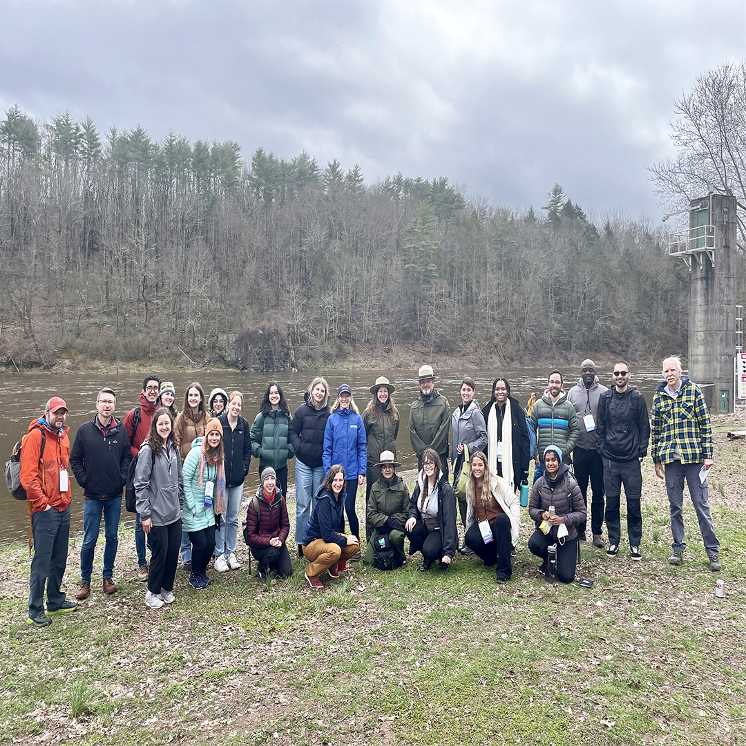 |
| SEJ Tour attendees grab a photo by the Delaware River at Milford Beach. Photo by the DRBC. |
The Society of Environmental Journalists (SEJ) held its annual conference in Philadelphia, Pa., last week. This year hosted by the University of Pennsylvania, the conference brought together environmental journalists from across the nation and world for a week-long event featuring workshops, panel discussions, speaker sessions and opportunities for networking and collaboration. The main plenary was a Q&A with EPA Administrator Michael Regan.
Also on the agenda were all-day tours and local mini-excursions, offering attendees various ways to learn more about the history, diversity and the environmental challenges and opportunities faced in the Delaware River Basin.
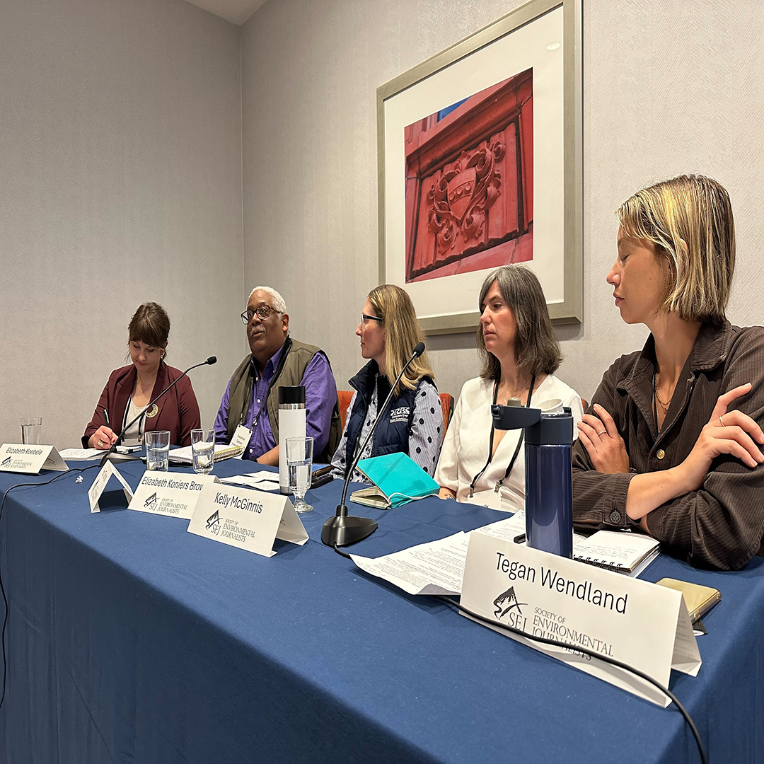
DRBC communications staff was invited to participate in the conference. On Wednesday, April 3, DRBC's Director of External Affairs and Communications Beth Brown was a panelist for the Policy at a Watershed Scale: Local Lessons, Collective Solutions track of the Beyond Extraction, Across Boundaries workshop. Brown discussed the unique makeup of the DRBC and how it works across political boundaries to manage, protect and improve water resources.
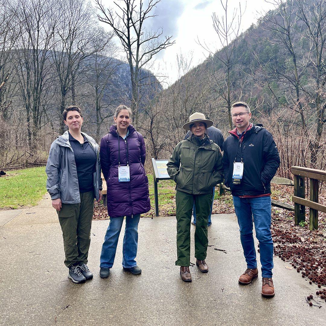
On April 4, Brown and Communications Specialist Kate Schmidt participated in the full-day tour of the Delaware Water Gap: Taken Land, Water Wars and an Uncertain Future. On the bus from Philadelphia, DRBC staff introduced folks to the Delaware River Basin and the DRBC, sharing our history and our part of the Tocks Island story. Staff also discussed the DRBC's role in the region today, especially in flow and drought management, protecting water quality and studying climate change.
Tocks Island was one of the first major projects planned by the DRBC when it was formed in 1961. Deemed necessary for flood protection, hydroelectric power and recreation opportunities, the dam would have created a lake from just north of the Delaware Water Gap to Port Jervis, N.Y., encompassing nearly 40 miles of river. The U.S. Army Corps of Engineers made a massive land grab from ~4,000 families in order to build the dam and create a national recreation area. Due to improper geology, water quality concerns, local and national opposition and sky rocketing costs, the DRBC voted no on the dam, and it was never built. But, for many who still live in the area, the wounds of its rise and fall are still raw.
The Delaware Water Gap National Recreation Area (DEWA) is what remains today, and it is in the top 20 most visited units of the National Park Service in the country.
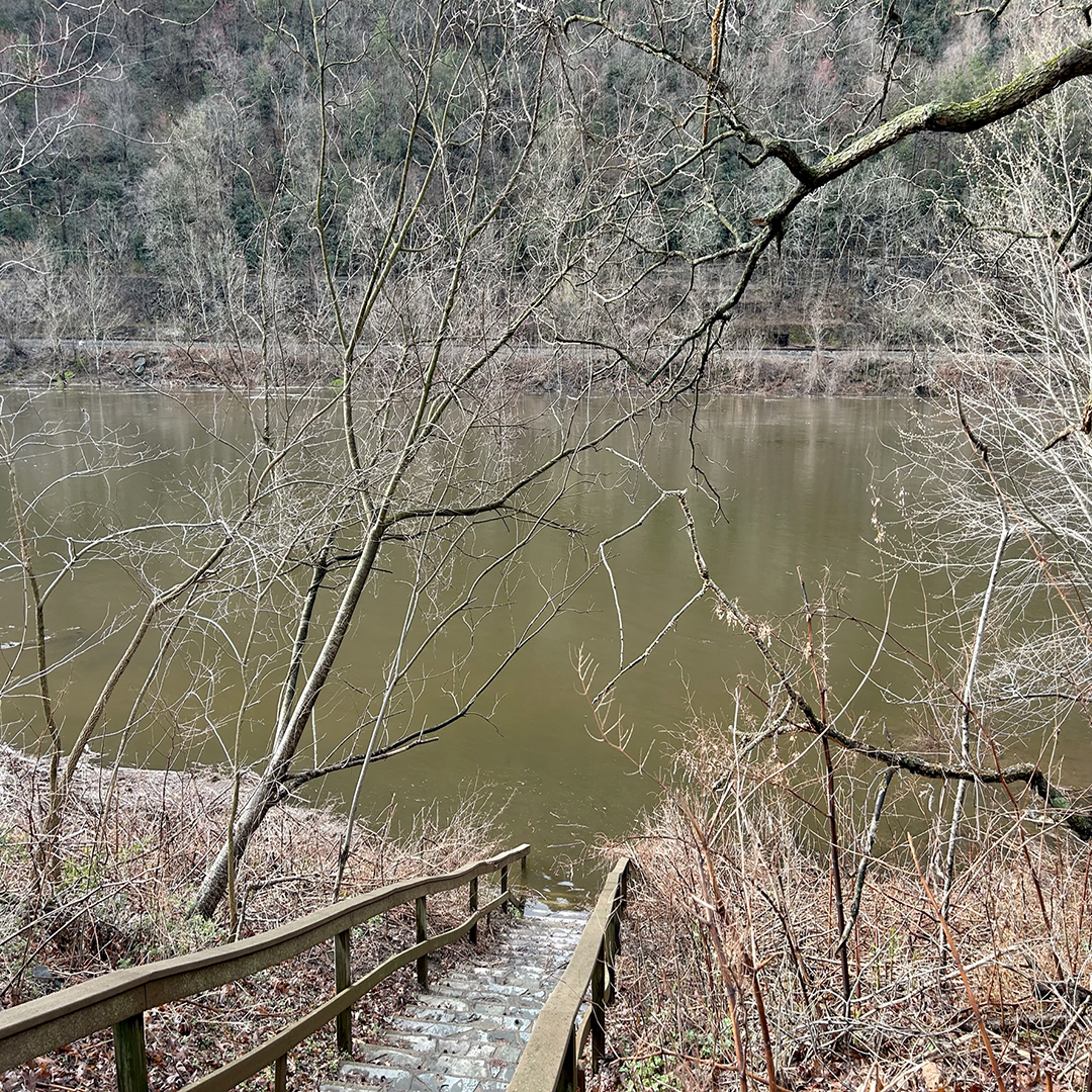
The first stop on the tour was Kittatinny Point, the Recreation Area's main visitor's center. Folks were able to stretch their legs after a two+ hour ride with views of a rain-swollen Delaware River and the Delaware Water Gap itself, between the peaks of Mount Minsi (Pa.) and Mount Tammany (N.J.). DEWA's Public Affairs Specialist Kathleen Sandt welcomed everyone to the park and to Kittatinny Point, while author David Pierce continued the Tocks Island story from the perspective of the people who suffered the loss of their homes.
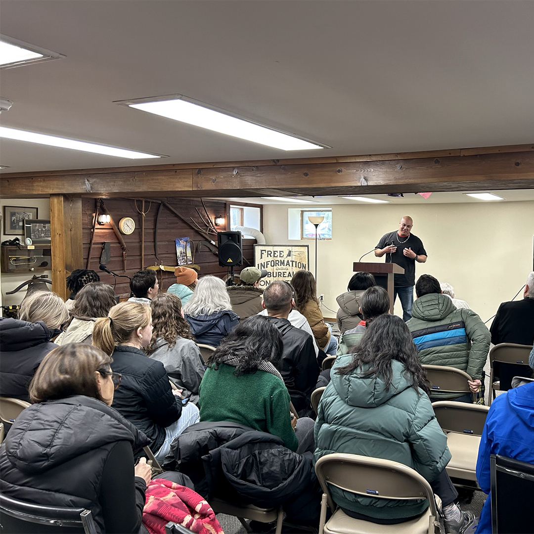
At the next stop in Milford, Pa., we heard from former DEWA Superintendent John Donahue about the proposal to make DEWA a national park. Delaware Tribe of Indians' Levi Randoll also spoke, telling the story of how his people were forced away from their ancestral lands in this area to Oklahoma, where many live today; one of his goals is to help people reconnect with their homeland. We also heard from the Coalition for the Delaware River Watershed's Meagan Schaefer about a successful federal grant program bringing money for on-the-ground restoration projects in the Delaware River Basin.
A stop to Milford Beach on the Delaware River was next, where we heard from DEWA Superintendent Doyle Sapp and staff about how they work to protect the park. Lindsay Kurnath, Superintendent of the Upper Delaware Scenic and Recreational River, was also in attendance and introduced attendees to her park, which sits just to the north of DEWA, and how the two parks work together. On the bus between stops, folks got to hear from USGS Deputy River Master Amy McHugh about her important responsibilities of implementing the directives of a 1954 US Supreme Court Decree and managing flows in the Delaware River. The final stop was a historic farmstead & (currently dormant) community garden within the park, highlighting the park's farming roots that are still growing today and its need for funding to refurbish existing structures and other park infrastructure.
Key themes were partnership, collaboration and conflict resolution, all of which are necessary for ensuring water resources are properly managed and protected for all. Other highlights included a spotting of a merganser pair floating in the river and a bald eagle soaring overhead!
Meg McGuire, founder of Delaware Currents, which covers all things Delaware River Basin, served as the SEJ 2024 Conference Chair. Learn more about the conference and SEJ: https://conference.sej.org/.
 |
 |
 |
| DRBC's Beth Brown (3rd from L) participates in a panel discussion. Photo courtesy of the Mississippi Ag & Water Desk. |
(from L to R) USGS Deputy Delaware River Master Amy McHugh, DRBC's Kate Schmidt, Delaware Water Gap National Recreation Area's Kathleen Sandt and Bloomberg's Bobby Magill grab a pic at Kittatinny Point. Photo by the DRBC. |
The Delaware River at the Kittatinny Point Visitor's Center. The river is running high; usually, there is a beach at the bottom of the stairs. Photo by the DRBC. |
 |
 |
 |
| (in hat, L) Delaware Water Gap National Recreation Area's Kathleen Sandt addresses tour attendees and welcomes them to the park. Photo by the DRBC. | Delaware Tribe of Indians' Levi Randoll addresses the group in Milford, Pa. He is involved with several initiatives to reconnect his people with their history and homelands in the Delaware River Basin. Photo by the DRBC. | Former Delaware Water Gap National Recreation Area Superintendent John Donahue talks to tour attendees in Milford, Pa. about a proposal to make the Recreation Area a National Park. Photo by the DRBC. |
 |
 |
 |
| The USGS' Montague Gage on the Delaware River provides vital data, supporting the water resource needs of over 14 million people. Photo by the DRBC. | Delaware Water Gap Superintendent Doyle Sapp (right, hat) and Water Gap staff introduce tour attendees to Milford Beach. Each discuss their role at the park and why their jobs are important. Photo by the DRBC. | Upper Delaware Scenic and Recreational River Superintendent Lindsay Kurnath (center, hat, arms out) addresses tour attendees at Milford Beach. She talked about her park and how it and the Water Gap are connected. Photo by the DRBC. |