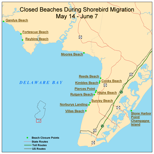
2005 Delaware Bay Beach Closure Location Map
The map below shows Delaware Bay and Atlantic coast beaches which will be closed from May 14 to June 7. Various beaches have closed seasonally since 2003 in order to protect a rapidly declining population of migrating shorebirds. These birds stop over each spring to feed on the fat-rich eggs of the horseshoe crab.(For more information on shorebirds see the Delaware Bay Shorebirds Information page.)
Closed areas will be marked with printed signs and rope fencing from the street end to the water's edge. DEP staff will be present to educate the public about the interaction between the shorebirds and horseshoe crabs and the need to let the birds feed undisturbed.
Detailed maps of the closed areas are linked from the map below by clicking on the beach name. Closed areas on those maps are indicated in red.
Delaware Bay Shorebirds brochure (has directions to viewing areas) (pdf, 425kb)
