Official Site of The State of New Jersey
Land Use Planning and Mapping
LPS is available to assist municipalities with updates to a Master Plan Land Use Element, covering but not limited to the following:
- Accounting of natural conditions
- Depicting of existing and proposed location, extent and intensity of future land development for varying types of uses and purposes
- Elucidating the relationship to existing and proposed zone plan and zoning ordinance, etc.
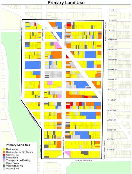
Land use mapping is a GIS service provided to assist with the visual depiction of existing land use patterns and plans for future land use via standard color classifications.
I want to...