|
New Jersey State Archives
225 West State Street-Level 2
P.O. Box 307
Trenton, NJ 08625-0307
Contact Information
Email: Feedback@sos.state.nj.us |

| Record
Group: |
Nathaniel
Rue Ewan (1870-1961) |
| Series: |
"Early
Houses of Burlington County, New Jersey" [Photograph Album],
1932-1949 |
| Accession
#: |
1939.002 |
| Series
#: |
PEWAN001 |
| Guide
Date: |
1/1995
(JK) |
| Volume: |
1
c.f. [1 box, 1 map] |
Content
Note | Contents | Place
Name Index | Surname
Index
Biographical
Note
Nathaniel Rue
Ewan of Moorestown, New Jersey, was born 28 April 1870 in the Ewan
family ancestral home at Ewansville, Burlington Co. His parents
were Charles Ewan Jr., a cider and vinegar manufacturer, and Mary
A. Wilkins. In 1894, N. R. Ewan married Ella L. Thomas of Camden.
By that time, he had taken up his father's cider and vinegar business,
which occupation he carried on until his retirement in 1936. Ewan
was also associated, during the course of his career, with three
independent telephone companies and served as president of the Vincentown
& Tabernacle Telephone Company for sixteen years. He was a member
of the Southampton Board of Education for several terms, and was
also president of the Associated School Board of Burlington County
for two terms.
Ewan possessed a great interest in the history of New Jersey and
particularly the history of Burlington County. Accordingly, for
four years he worked for the Library of Congress on the Historic
American Building Survey. Ewan was a principal participant of the
Survey in Burlington County, and personally located and photographed
scores of private and public historic structures. In his retirement,
Ewan served as president of the Burlington County Historical Society
as well as curator and treasurer of the Camden County Historical
Society. He was also appointed by Governor Edison in November 1943
as a member of the New Jersey Historic Sites Commission.
N. R. Ewan died 10 January 1961 at the Masonic Home in Burlington
Township, aged 90 years.
Bibliography
The Story of
New Jersey, Volume V. (New York, NY: Lewis Historical Publishing
Co., 1945). "Nathaniel R. Ewan," pp. 1045-1046.
|
Content
Note
This
series contains 110 photographs taken by N. R. Ewan during the 1930s
showing pre-1800 private homes and outbuildings in Burlington County.
The photographs were presented to the New Jersey State Library in
1939 as a two-part album. For each view, Ewan provided a detailed
caption summarizing the known history of the structure. For the
purposes of preservation, the photographs have been removed from
the original (highly acidic) album pages and placed in plastic sleeves.
In addition, the captions have been photocopied onto acid-free bond
paper and placed within the sleeves, behind the corresponding photographs.
As mentioned above, Ewan served as a photographer for the Historic
American Building Survey (HABS) in Burlington County. Consequently,
similar--but not identical--views of many of the structures included
here can be found among the HABS documentation photographs. Ewan's
1939 album, nevertheless, seems to include only prints from his
private collection, not copies of HABS photographs. In the latter,
New Jersey site number signs can be seen in exterior views.
It should be noted that Ewan had previously donated (by 1935) similar
albums to the Burlington County Historical Society, the Burlington
County Library at Mount Holly, and the Moorestown Library. This
was reported in a Mount Holly Herald article that year
which also contained the complete list of 107 captions.
(Copies of this article and another by Ewan entitled "How Old
is Your House?" are included with this series as the first
items in the box). Ewan added three views in the 1939 album, and
also revised several of the 1935 captions. Also, inserted in the
album (between site nos. 107 and 108) was a 1949 photograph of a
log house on Burlington Road which was demolished that year. This
item might have been a later addition by the donor.
Finally, Ewan also included his donation to the State Library a
copy of a Burlington County map on which he marked the approximate
locations of each structure photographed. The key map is stored
unfolded and rolled.
Contents
(click on image below for enlarged view)
NOTE: Included below are basic descriptions of the structures photographed
by Ewan using his 1939 captions, the 1935 Mount Holly Herald article, and the key map. The accuracy of the descriptions
has not been verified. Place name and surname indexes
have been added following the Contents list to
aid researchers.
|
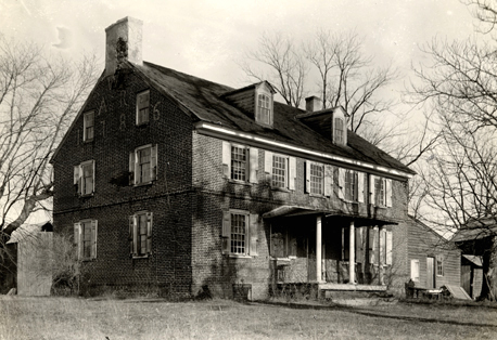
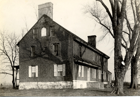
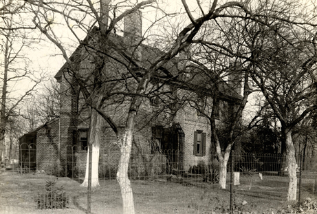
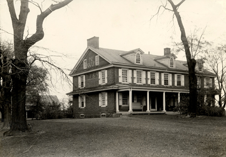
| No. |
Description
(see caption for further details) |
Image |
| -- |
Copy
of Map of Burlington County, New Jersey (General Drafting
Co., Inc., N.Y., no date) showing "Approximate location of Colonial
Houses in Burlington Co. numbered to correspond with collection of
photographs by N. R. Ewan, Moorestown, N.J." [stored rolled in
tube]. |
|
--
|
Newspaper
articles by N. R. Ewan: "Colonial Homes of Burlington County
Built Prior to 1800," Mount Holly Herald, 1935 [photocopy
of bound copy in New Jersey State Library]; "How Old is Your House?," West Jersey Press, 18 April 1940 [photocopy]. |
|
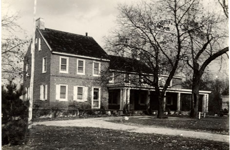
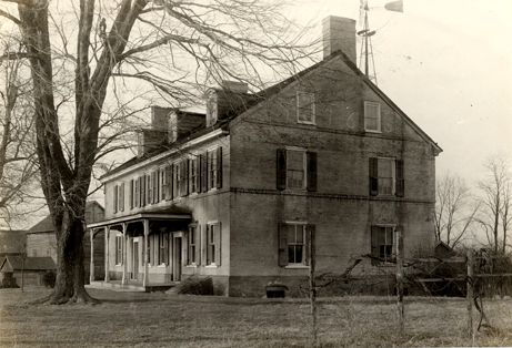
1.
|
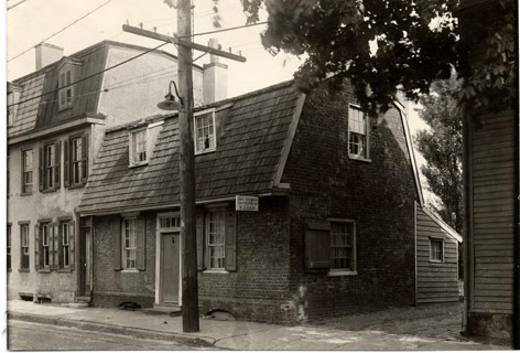
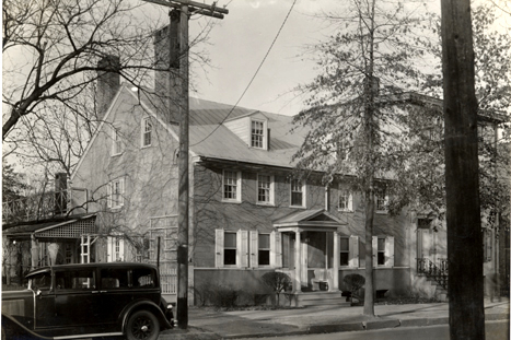
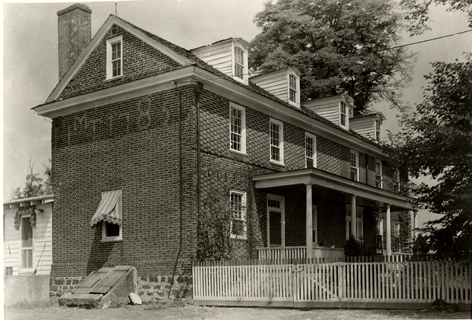
Thomas
Revell/Isaac Decow House (built by George Hutchinson), Pearl Street,
Burlington, 1685. |
|
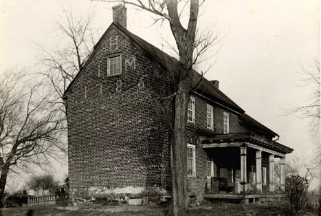
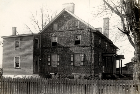
2.
|
John
Rogers House, near Springside, Burlington Twp., 1718. |
|
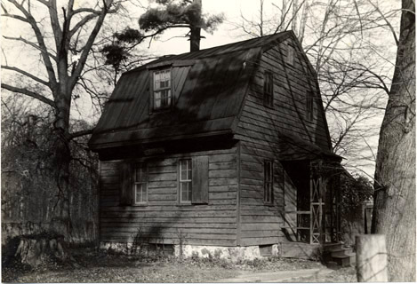
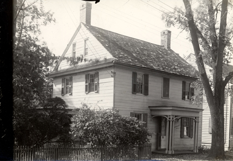
3.
|
Samuel
Allen House ("Ivystone"), near Five Points, Cinnaminson Twp.,
1762. |
|
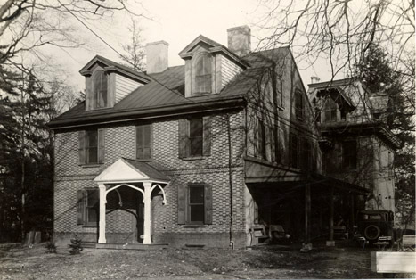
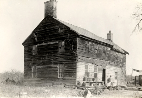
4.
|
Hewlings
Homestead, River Road near Riverside, Delran Twp., date unknown.
|
|
5.
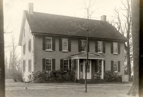
|
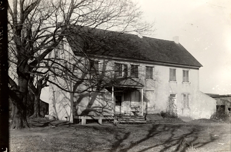
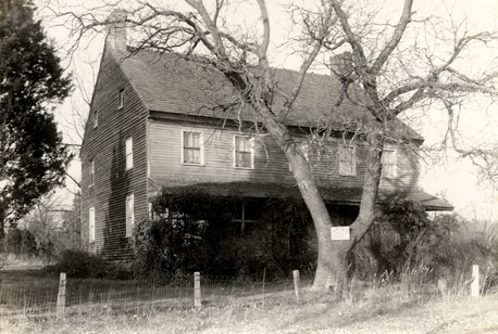
Zelley property, North Stanwick Ave., Moorestown, 1721. |
|
6.
|
Spring
Valley Country Club (includes Jeremiah Matlack home), near Maple Shade,
Chester Twp., ca. 1753. |
|
7.
|
Hezekiah and Mary Jones House, South Pemberton Road near Smithville,
Southampton Twp., 1791. |
|
8.
|
John
and Mary Hollingshead/David and Sarah Peacock House, Pemberton-Vincentown
Road, Southampton Twp., 1785/1812.
|
|
9-10.
|
Parrish
House, Oxmead Road, Burlington Twp., pre-1800. |
|
11.
|
William
Pew House, Oxmead and Burrs Roads, Westampton Twp., early 1800s. |
|
12.
|
John
Woolman/Jabez Woolston Residence, Branch Street, Mount Holly, 1771. |
|
13.
|
John
and Kesiah Burr Homestead (rebuilt), Burrs Road, Westampton Twp.,
1725/1732. |
|
14.
|
Joseph
Moore House, Bulls Head Road, Lumberton vicinity, 1754. |
|
15.
|
Thomas
and Rebecca Haines House, Rancocas-Wood Lane Road, Westampton Twp.,
1775 (owned by Harold Pew, 1935). |
|
16.
|
George
and Sarah Elkington/Joseph Borton House, Rancocas-Burlington Road,
Westampton Twp., 1765/1835. |
|
17.
|
Thomas
and Tabitha (Huggs) Buzby House, Rancocas-Beverly Road (on Rancocas
River) near Franklin Park property, Willingboro Twp., 1783. |
|
18.
|
Ancient
frame house, just north of Rancocas Village, Willingboro Twp., pre-1700
(occupied by Robert Haines, 1925-1930; owned by William Grovatt Sr.,
1939). |
|
19.
|
Aaron
and Rachel Wills House, Rancocas-Centerton Road, Westampton Twp.,
1786. |
|
20.
|
Brick
house (builder unknown), Rancocas-Mount Holly Road, Westampton Twp.,
1756. |
|
21.
|
John
Woolston House, north of Rancocas River near Ewansville, Pemberton
Twp., 1710-1720. |
|
22.
|
Eayres
Residence (mill property), Lumberton Twp., 1769. |
|
23.
|
Michael
and Susannah Newbold House, Georgetown-Wrightstown Road near Monmouth
Road, Chesterfield Twp., 1736 (owned by Mrs. John Hutchinson, 1939). |
|
24.
|
Caleb/Clayton
and Mary Newbold House, Chesterfield Twp., 1764 (owned by Mrs. John
Hutchinson, 1935). |
|
25.
|
William
and Susan Newbold House, one mile east of Georgetown, Chesterfield
Twp., 1769 (owned by Mrs. John B. Atkinson, 1939). |
|
26.
|
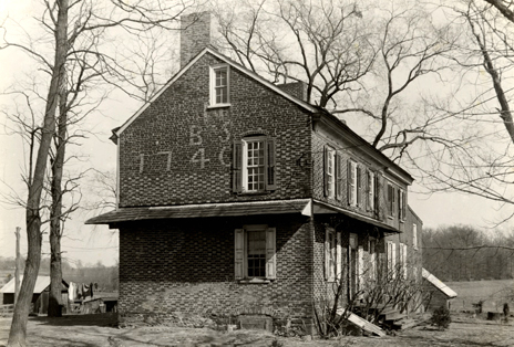
Barzilla
and Sarah Newbold House (Bowne House), Georgetown-Columbus Road, Mansfield
Twp., 1740. |
|
27.
|
Anthony
and Ann Taylor House (also has Newbold connection), private lane leading
from Chesterfield-Bordentown Road, near Chesterfield, 1766. |
|
28.
|
Joseph
and Hannah Buzby House, near Charleston (Beverly section), Willingboro
Twp., 1764 (owned by Joseph Wills, 1939). |
|
29.
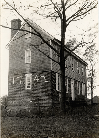
|
Early
Shreve House, Columbus-Georgetown Road near Bowne property, Mansfield
Twp., 1742. |
|
30.
|
John
and Elizabeth Hough House, near Juliustown/Houghton, Springfield Twp.,
1763. |
|
31.
|
Hudson
and Mary Burr House, on lanes leading from Vincentown-Pemberton and
South Pemberton Roads, Southampton Twp., 1785 (occupied by Clinton
Worrell, 1935). |
|
32.
|
Jos.
and Mary Wills House (Dr. Wills property), below Marlton, Evesham
Twp., 1789. |
|
33.
|
William
and Mary Ridgway House, near Charleston (Beverly vicinity), Willingboro
Twp., 1789. |
|
34.
|
Brick
house owned by Daniel Lippincott in 1778, Marlton vicinity, Evesham
Twp., date unknown. |
|
35.
|
John
Ridgway House, on obscure road leading from Monmouth Road to Columbus-Georgetown
Road, Georgetown vicinity, Springfield Twp., 1753. |
|
36.
|
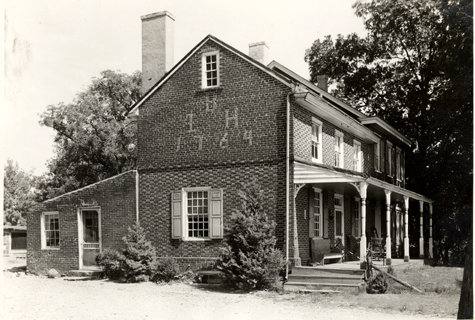
Cowperthwait
Homestead, Moorestown-Haddonfield Road, Moorestown Twp., 1742 or 1755-1760. |
|
37.
|
John
and Mary Roberts House, Lenola-Fellowship Road, Moorestown Twp., 1736. |
|
38.
|
Frame
house, old Monmouth Road east of Wrightstown Road intersection, near
Sykesville, Chesterfield Twp., 1757. |
|
39.
|
Traditional
headquarters of General Clinton when encamped at Evesham (1778), Mount
Laurel-Evesboro Road, Mount Laurel Twp., 1744. |
|
40.
|
J.
Brognard/John Poinsett House, Monmouth Road near Sykesville, North
Hanover Twp., ca. 1790 (owned by H. C. Poinsett, 1935). |
|
41.
|
Glazed
brick house near Charleston, Burlington Twp., 1780 (owned by Howard
Wills, 1939). |
|
42.
|
William
Matlack House, School House Lane near Colestown, Chester Twp., 1751. |
|
43.
|
Francis
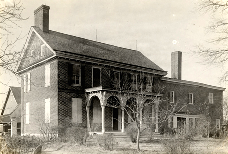
Hopkinson House (built by John Imlay), Park Avenue, Bordentown, 1750
(owned by Judge Harold B. Wells, 1939). |
|
44.
|
Brick
and frame house, Fellowship-Church Road, Mount Laurel Twp., date unknown
(owned by Richard Hugg, 1845). |
|
45.
|
Darling
and Deliverance Conroe House, near Burlington Pike on Haines Mill
Road, Delran Twp., 1751. |
|
46.
|
William
or Joseph Lawrie House, Arneytown, North Hanover Twp., date unknown. |
|
47.
|
Brick
house on Deer Seed/Campbell Soup Farm, near Moorestown, Delran Twp.,
date unknown. |
|
48.
|
Samuel
B. Lippincott/Pemberton Borton property, near Green Tree-Hainesport
Road, Mount Laurel Twp., ca. 1785. |
|
49.
|
Thomas
and Hannah Tallman House, Bortons Landing Road near Long Crossing,
Moorestown Twp., 1757. |
|
50.
|
Darnell
House, Route 38 near Masonville, Mount Laurel Twp., date unknown (owned
by Dr. Kaufman, 1939). |
|
51.
|
Jacob
Hewlings House, Green Tree-Vincentown/Hainesport Road, Evesham Twp.,
1797. |
|
52.
|
William
Rogers House, Mount Laurel Twp., 1769. |
|
53.
|
Brick
house, Jacksonville (Slabtown), Springfield Twp., 1761. |
|
54.
|
Amos
Wilkins House, Lumberton-Medford Road near Cross Roads, Medford Twp.,
1787. |
|
55.
|
Edward
Tonkin/Black Family House, Jacksonville-Jobstown Road near Smithville,
Springfield Twp., date unknown (owned by John Hancock, 1939). |
|
56.
|
Isaac
Evans House (on site of 1715 house of Thomas Evans), Evesham Twp.,
1769 (owned by Dr. Haines, 1935). |
|
57.
|
Revolutionary
House, Crosswicks, Chesterfield Twp., date unknown (owned by Mary
Braslain, 1935). |
|
58.
|
Deacon
House, Elbow Lane Road near Deacons Station, Mount Holly-Burlington
Road, Burlington Twp., 1744. |
|
59.
|
Amos
Middleton House, Crosswicks, Chesterfield Twp., ca. 1750. |
|
60.
|
Darnell
property, Hainesport-Mount Laurel Road, Mount Laurel Twp., 1782. |
|
61.
|
Thomas
and Mary Evans House, Marlton-Medford Road, Evesham Twp., 1785. |
|
62.
|
Frame
house, brick paned, on obscure lane leading from Mount Holly-Rancocas
Road (possibly a Woolman farmhouse), Westampton Twp., date unknown. |
|
63.
|
Neddy
French House, Moorestown Twp., ca. 1770. |
|
64.
|
Brick
house on George P. Lippincott farm, Green Tree-Mount Laurel Road near
Green Tree, Evesham Twp., 1785. |
|
65-66.
|
Samuel
Emley House, Arneytown Road near Jacobstown, North Hanover Twp., 1784,
and Emley homestead property. |
|
67.
|
Gaskill
House, Monmouth Road west of Jobstown, Springfield Twp., 1792 (one-time
residence of Charles Pew). |
|
68.
|
Julius
Ewan House, Juliustown, Springfield Twp., date unknown. |
|
69.
|
Samuel
Risdon House, Garden Street, Mount Holly, date unknown (owned by the
Misses Etris, 1939). |
|
70.
|
Bullock
Homestead, Monmouth Road at intersection of Jacobstown Road, near
Jacobstown, North Hanover Twp., late-18th century. |
|
71.
|
Jonathan
Haines House, near Kirbys Mills (formerly Haines Mills/ Prickitts
Mills), Medford Twp., 1720 (owned by Mr. F. Tschirner, 1939). |
|
72.
|
Brick
Family Homestead, just west of Marlton village, Evesham Twp., ca.
early 1800s (owned by Albert Lippincott, 1939). |
|
73.
|
Thomas
Taylor/Applegate House, Georgetown (formerly Foolstown), Mansfield
Twp., 1765 (owned by Mrs. Horace McIlvain, 1939). |
|
74.
|
Field
Mansion/Richards Tavern on Delaware River (also owned by Richard Brown),
Fieldsboro (formerly White Hill), possibly 1725 (owned by Mrs. Douglas,
1939). |
|
75.
|
Thomas
Woodward House, on Keith's Province Line, just north of Arneytown,
Upper Freehold Twp., Monmouth Co., 1735/1783 (owned by Mr. & Mrs.
Duncan MacKenzie, 1939). |
|
76.
|
Dr.
Edward Shippen/James or William Askew House, Burlington, 1764. |
|
77.
|
Birthplace
of James Fenimore Cooper/Captain James Lawrence, Burlington, partly
pre-1700 (Cooper birthplace owned by Burlington County Historical
Society, 1939). |
|
78.
|
Beldin
House, Wood Street, Burlington, 1797. |
|
79.
|
Fenimore
House, York Street, Burlington, date unknown. |
|
80.
|
Boudinot/Bradford
House, Burlington, ca. 1800. |
|
81.
|
Isaac
Collins House, Broad Street, Burlington, ca. 1780-1790. |
|
82.
|
Black
Homestead, north side of Monmouth Road, east of Jobstown, Springfield
Twp., date unknown (owned "recently" by Henry Black, 1939). |
|
83.
|
J.
Black Smokehouse, Monmouth Road, Springfield Twp., 1786 (see no. 82
above). |
|
84.
|
Solomon
Mason House, south side of Marlton-Medford Road, Evesham Twp., date
unknown. |
|
85.
|
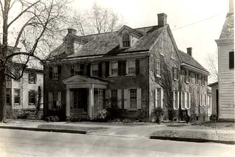
Samuel/Richard
Smith House, High Street, Moorestown, ca. 1765/1798 (owned by John
Cadbury, 1939). |
|
86.
|
William
Roberts House, West Main Street, Moorestown, ca. 1765/1785. |
|
87.
|
Prickitt
Family House (possibly built by Allen family), near Sandtown (Medford
vicinity), formerly Prickittown, Southampton Twp., 1782. |
|
88.
|
Wading
River/Bridgeport Tavern, Washington Twp., date unknown. |
|
89.
|
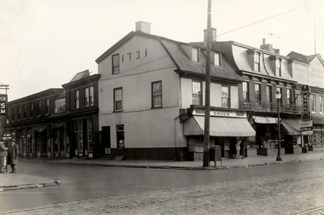
William
Allinson House (apothecary), High Street, Burlington, 1731. |
|
90.
|
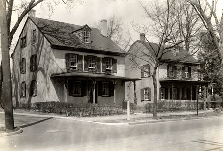
Dr.
Samuel Haines Residence, East Main Street, Moorestown, ca. 1750. |
|
91.
|
J.
Bispham House/Friends Meeting House, Main and Schooly Sts., Moorestown,
ca. 1744. |
|
92.
|
Farmhouse,
side road leading from Florence to Columbus-Burlington Road, Florence
Twp., 1752. |
|
93.
|
"Hoot
Owl" Farm, north of old Tuckerton Road near Taunton Lakes Stream,
Evesham Twp., 1772. |
|
94.
|
Silas
Walton/J. Bispham/Commodore Truxton House, Moorestown-Mount Holly
Road near Long Crossing, Moorestown Twp., date unknown. |
|
95.
|
William
Stackhouse/William H. Burr House, Main Street, Mount Holly, date unknown. |
|
96.
|
Major
Joseph Budd House ("Mud Farm"), Buddtown-Birmingham Road, Southampton
Twp., ca. 1750. |
|
97.
|
Brick
House, east side of Mount Holly-Jacksonville Road, Eastampton Twp.,
date unknown (owned by Frank E. Snyder, 1935). |
|
98.
|
Gleason
Farmhouse (possibly built by Budd family), west side of Buddtown-Birmingham
Road, Southampton Twp., date unknown. |
|
99.
|
Morris
Mansion (formerly known as "Yellow Mansion"), possibly built
by Thomas or David Budd, Pemberton, pre-1752. |
|
100.
|
James
Kinsey/William Griffith/Moose Family House, Broad St., Burlington,
date unknown (owned by Dr. Cassidy in "recent years," 1939). |
|
101.
|
Stokes/Gaskill/Kemble/Johnson
Family House, west side of Mount Holly-Jacksonville Road, Springfield
Twp., 1766 (owned by Fenton and Zelley families, late-eighteenth century;
owned by George Winzinger, 1939). |
|
102.
|
Thomas
Rogers House, Jacksonville-Kinkora Road/Jacksonville to Columbus-Burlington
Road, Mansfield Twp., date unknown. |
|
103.
|
Huff/Hough
Family Home, Arneys Mount-Juliustown Road, Springfield Twp., ca. 1780-1800. |
|
104.
|
Jacob
Merritt House, Chambers Corner-Arneys Mount Road, Springfield Twp.,
1785 (owned by Shreve Lippincott, 1935; owned by Mr. Paul, 1939). |
|
105.
|
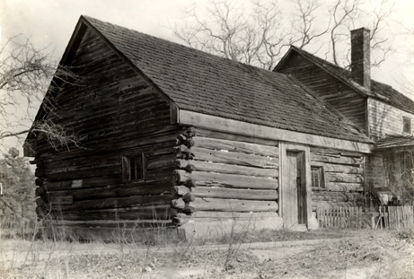
Log
Cabin (possibly built by Peter Bard), Upper Mills, Pemberton Twp.,
1720 (owned by Henry Black, 1935). |
|
106.
|
Farmhouse,
east side of Vincentown-Pemberton Road, Southampton Twp., 1753 (owned
by Howard Robbins, 1939). |
|
107.
|
Small
tenant house on Fleetwood Farm at entrance to old Salem Road (possibly
one-time tollhouse on Burlington Pike), Burlington Twp., ca. 1798. |
|
107a.
|
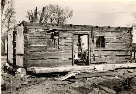
Log
House, Burlington Pike, now Beverly Road, date unknown (demolished
1949) [loose photograph inserted in album]. |
|
108.
|
P.
Burr/Deacon Family House, east side of Mount Holly-Burlington Road
near entrance to Oxmead Road, Westampton Twp., 1787. |
|
109.
|
Haines
House (on land of Dr. Robert Dimsdale), long lane leading from Lumberton
Village, 1776 (owned by Joseph Jones, 1939). |
|
110.
|
Log
stable on Stiles Farm (possibly built by the Moore family; owned by
Charles Read Sr., 1756), north side of Bulls Head Road between Lumberton
and Rancocas Park, Lumberton Twp., date unknown. |
|
Place
Name Index
Arneys
Mount-Juliustown Road, 103 |
| Arneys
Mount-Chambers Corner Road, 104 |
| Arneytown,
46, 75 |
| Arneytown
Road, 65-66 |
| Beverly,
28, 33 |
| Beverly
Road, 107a |
| Beverly-Rancocas
Road, 17 |
| Birmingham-Buddtown
Road, 96, 98 |
| Bordentown,
43 |
| Bordentown-Chesterfield
Road, 27 |
| Bortons
Landing Road, 49 |
| Bridgeport,
88 |
| Buddtown-Birmingham
Road, 96, 98 |
| Bulls
Head Road, 14, 110 |
| Burlington
(City), 1, 76, 77, 78, 79, 80, 81, 89, 100 |
| Burlington
Pike, 45, 107, 107a |
| Burlington
Twp., 2, 9-10, 41, 58, 107 |
| Burlington-Columbus
Road, 92, 102 |
| Burlington-Mount
Holly Road, 58, 108 |
| Burlington-Rancocas
Road, 16 |
| Burrs
Road, 11, 13 |
| Centerton-Rancocas
Road, 19 |
| Chambers
Corner-Arneys Mount Road, 104 |
| Charleston,
28, 33, 41 |
| Chester
Twp., 6, 42, 59 |
| Chesterfield
Twp., 23, 24, 25, 27, 38, 57, 59 |
| Chesterfield-Bordentown
Road, 27 |
| Cinnaminson
Twp., 3 |
| Colestown,
42 |
| Columbus-Burlington
Road, 92, 102 |
| Columbus-Georgetown
Road, 26, 29, 35 |
| Columbus-Jacksonville
Road, 102 |
| Cross
Roads, 54 |
| Crosswicks,
57, 59 |
| Darnells
Mills, 50 |
| Deacons
Station, 58 |
| Delaware
River, 74 |
| Delran
Twp., 4, 45, 47 |
| Eastampton
Twp., 97 |
| Eayrestown,
22 |
| Elbow
Lane Road, 58 |
| Evesham
Twp., 32, 34, 39, 51, 56, 64, 72, 84, 93 |
| Ewansville,
21 |
| Fellowship-Church
Road, 44 |
| Fellowship-Lenola
Road, 37 |
| Fieldsboro,
74 |
| Five
Points, 3 |
| Florence
Twp., 92 |
| Foolstown,
73 |
| Georgetown,
25, 35, 73 |
| Georgetown-Columbus
Road, 26, 29, 35 |
| Georgetown-Wrightstown
Road, 23 |
| Green
Tree, 64 |
| Green
Tree-Hainesport Road, 48, 51 |
| Green
Tree-Mount Laurel Road, 64 |
| Green
Tree-Vincentown Road, 51 |
| Haddonfield-Moorestown
Road, 36 |
| Haines
Mills, 71 |
| Haines
Mill Road, 45 |
| Hainesport-Green
Tree Road, 48, 51 |
| Hainesport-Mount
Laurel Road, 60 |
| Houghton,
30 |
| Jacksonville,
53, 102 |
| Jacksonville-Columbus
Road, 102 |
| Jacksonville-Jobstown
Road, 55 |
| Jacksonville-Kinkora
Road, 102 |
| Jacksonville-Mount
Holly Road, 97, 101 |
| Jacobstown,
65-66, 70 |
| Jacobstown
Road, 70 |
| Jobstown,
67, 82 |
| Jobstown-Jacksonville
Road, 55 |
| Juliustown,
30, 68 |
| Juliustown-Arneys
Mount Road, 103 |
| Kinkora-Jacksonville
Road, 102 |
| Kirbys
Mills, 71 |
| Lenola-Fellowship
Road, 37 |
| Long
Crossing, 49, 94 |
| Lumberton
Twp., 14, 22, 109, 110 |
| Lumberton-Medford
Road, 54 |
| Mansfield
Twp., 26, 29, 73, 102 |
| Maple
Shade, 6 |
| Marlton,
32, 34, 72 |
| Marlton-Medford
Road, 61, 84 |
| Masonville,
50 |
| Medford
Twp., 54, 71, 87 |
| Medford-Lumberton
Road, 54 |
| Monmouth
County, 75 |
| Monmouth
Road, 23, 35, 38, 40, 67, 70, 82, 83 |
| Moorestown
Twp., 5, 36, 37, 47, 49, 63, 85, 86, 90, 91, 94 |
| Moorestown-Haddonfield
Road, 36 |
| Moorestown-Mount
Holly Road, 94 |
| Mount
Holly Twp., 12, 69, 95 |
| Mount
Holly-Burlington Road, 58, 108 |
| Mount
Laurel-Green Tree Road, 64 |
| Mount
Holly-Jacksonville Road, 97, 101 |
| Mount
Holly-Moorestown Road, 94 |
| Mount
Holly-Rancocas Road, 20, 62 |
| Mount
Laurel Twp., 39, 44, 48, 50, 52, 60 |
| Mount
Laurel-Evesboro Road, 39 |
| North
Hanover Twp., 40, 46, 65-66, 70 |
| Oxmead
Road, 9-10, 11, 108 |
| Pemberton
(Bor. and Twp.), 21, 99, 105 |
| Pemberton-Vincentown
Road, 8, 31, 106 |
| Prickittown,
87 |
| Prickitts
Mills, 71 |
| Rancocas
Park, 110 |
| Rancocas
River, 17, 21 |
| Rancocas
Village, 18 |
| Rancocas-Beverly
Road, 17 |
| Rancocas-Burlington
Road, 16 |
| Rancocas-Centerton
Road, 19 |
| Rancocas-Mount
Holly Road, 20, 62 |
| Rancocas-Wood
Lane Road, 15 |
| River
Road, 4 |
| Riverside,
4 |
| Route
38, 50 |
| Salem
Road, 107 |
| Sandtown,
87 |
| School
House Lane, 42 |
| Slabtown,
53 |
| Smithville,
7, 55 |
| South
Pemberton Road, 7, 31 |
| Southampton
Twp., 7, 8, 31, 87, 96, 98, 106 |
| Springfield
Twp., 30, 35, 53, 55, 67, 68, 82, 83, 101, 103, 104 |
| Springside,
2, 59 |
| Sykesville,
38, 40 |
| Taunton
Lakes Stream, 93 |
| Tuckerton
Road, 93 |
| Upper
Freehold Twp., 75 |
| Upper
Mills, 105 |
| Vincentown-Green
Tree Road, 51 |
| Vincentown-Pemberton
Road, 8, 31, 106 |
| Wading
River, 88 |
| Washington
Twp., 88 |
| Westampton
Twp., 11, 13, 15, 16, 19, 20, 62, 108 |
| White
Hill, 74 |
| Willingboro
Twp., 17, 18, 28, 33 |
| Wood
Lane-Rancocas Road, 15 |
| Wrightstown
Road, 38 |
Wrightstown-Georgetown
Road, 23
Back to Top |
Surname
Index
Allen,
3, 87 |
| Allinson,
89 |
| Applegate,
73 |
| Askew,
76 |
| Atkinson,
25 |
| Ayres,
22 |
| Bard,
105 |
| Beldin,
78 |
| Bispham,
91, 94 |
| Black,
55, 82, 83, 105 |
| Borton,
16, 48 |
| Boudinot,
76, 80 |
| Bowne,
26, 29 |
| Bradford,
80 |
| Braslain,
57 |
| Brick,
72 |
| Brognard,
40 |
| Brown,
74 |
| Bullock,
70 |
| Budd,
96, 98, 99 |
| Burr,
13, 31, 95, 108 |
| Buzby,
17, 28 |
| Cadbury,
85 |
| Cassidy,
100 |
| Clinton,
39 |
| Collins,
81 |
| Conroe,
45 |
| Cooper,
77 |
| Cowperthwait,
36 |
| Darnell,
50, 60 |
| Deacon,
58, 108 |
| Decow,
1 |
| Dimsdale,
109 |
| Douglas,
74 |
| Eayres,
22 |
| Elkington,
16 |
| Emley,
65, 66 |
| Etris,
69 |
| Evans,
56, 61 |
| Ewan,
68 |
| Fenimore,
79 |
| Fenton,
101 |
| Field,
74 |
| Fleetwood,
107 |
| French,
63 |
| Gaskill,
67, 101 |
| Gleason,
98 |
| Griffith,
100 |
| Grovatt,
18 |
| Haines,
15, 18, 56, 71, 90, 109 |
| Hancock,
55 |
| Hewlings,
4, 51 |
| Hollingshead,
8 |
| Hopkinson,
43 |
| Hough/Huff,
30, 103 |
| Hugg,
44 |
| Huggs,
17 |
| Hutchinson,
1, 23, 24 |
| Imlay,
43 |
| Johnson,
101 |
| Johnson,
101 |
| Jones,
7, 109 |
| Kaufman,
50 |
| Kemble,
101 |
| Kinsey,
100 |
| Lawrence,
77 |
| Lawrie,
46 |
| Lippincott,
3, 34, 48, 64, 72, 104 |
| MacKenzie,
75 |
| Mason,
84 |
| Matlack,
6, 42 |
| McIlvain,
73 |
| Merritt,
104 |
| Middleton,
59 |
| Moore,
14, 110 |
| Moose,
100 |
| Morris,
99 |
| Newbold,
23, 24, 25, 26, 27 |
| Park,
17 |
| Parrish,
9, 10 |
| Paul,
104 |
| Peacock,
8 |
| Pew,
11, 67 |
| Poinsett,
40 |
| Prickitt,
87 |
| Read,
110 |
| Revell,
1 |
| Richards,
74 |
| Ridgway,
33, 35 |
| Risdon,
69 |
| Robbins,
106 |
| Roberts,
37, 86 |
| Rogers,
2, 52, 102 |
| Shippen,
76 |
| Shreve,
29 |
| Smith,
85 |
| Snyder,
97 |
| Stackhouse,
95 |
| Stiles,
110 |
| Stokes,
101 |
| Tallman,
49 |
| Taylor,
27, 73 |
| Tonkin,
55 |
| Truxton,
94 |
| Tschirner,
71 |
| Walton,
94 |
| Wells,
43 |
| Wilkins,
54 |
| Wills,
19, 28, 32, 41 |
| Winzinger,
101 |
| Woodward,
75 |
| Woolman,
12, 20, 62 |
| Woolston,
12, 21 |
| Worrell,
31 |
| Zelley,
5, 101 |
|