No.
|
Caption
|
Image |
33.
|
"Canal
East of Boonton." [looking south]
|
|
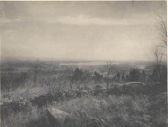
34.
|
"Boonton
from Sheep's Hill. Canal running through centre of Town."
|
|
35.
|
"Boonton,
Near Lock 13 East." [looking west]
|
|
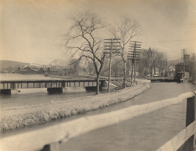
36.
|
"Canal
at Boonton, looking East." [showing basin near foot of plane]
|
|
37.
|
"Canal
at Boonton, looking East." [looking east toward the top of
Plane 7 East]
|
|
38.
|
"Boonton
from the Bridge." [looking north]
|
|
39.
|
"Canal
West of Lock 12 East, near Boonton." [looking west]
|
|
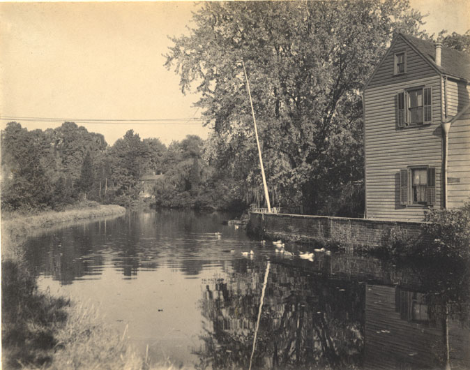
40.
|
"Powerville
Basin and Lock 10 East near Boonton." [looking north]
|
|
41.
|
"Lock
10 East, Powerville." [looking south]
|
|
42.
|
"Lock
13 East - East of Boonton." [looking north]
|
|
43.
|
"Canal
West of Boonton."
|
|
44.
|
"Canal
at Denville." [looking west; actually Lincoln Park]
|
|
45.
|
"Canal at Rockaway."
|
|
46.
|
"Lock
1 East, Drakesville." [Ledgewood; looking east]
|
|
47.
|
"Canal
passing through Rockaway, looking South East." [possibly looking
northwest]
|
|
48.
|
"The
Canal at Rockaway, looking North East." [possibly looking northwest]
|
|
49.
|
"Dover,
Canal through Centre of Town." [looking north]
|
|
50.
|
"Canal
Entering Dover, going East."
|
|
51.
|
"Foot
of Plane 5 East - West of Dover, showing Canal Bed." [looking
west, apparently during a washout]
|
|
52.
|
"Lock
2 East near Lake Hopatcong." [actually at Wharton]
|
|
![“Canal East of Boonton”. [looking south]](images/szmor001/SZMOR001-033.jpg)
!["Boonton, Near Lock 13 East." [looking west]](images/szmor001/SZMOR001-035.jpg)
!["Canal at Boonton, looking East." [showing basin near foot of plane]](images/szmor001/SZMOR001-036.jpg)
!["Canal at Boonton, looking East." [looking east toward the top of Plane 7 East]](images/szmor001/SZMOR001-037.jpg)
!["Boonton from the Bridge." [looking north]](images/szmor001/SZMOR001-038.jpg)
!["Canal West of Lock 12 East, near Boonton." [looking west]](images/szmor001/SZMOR001-039.jpg)
!["Powerville Basin and Lock 10 East near Boonton." [looking north]](images/szmor001/SZMOR001-040.jpg)
!["Lock 10 East, Powerville." [looking south]](images/szmor001/SZMOR001-041.jpg)
!["Lock 13 East - East of Boonton." [looking north]](images/szmor001/SZMOR001-042.jpg)
!["Canal at Denville." [looking west; actually Lincoln Park]](images/szmor001/SZMOR001-044.jpg)

!["Lock 1 East, Drakesville." [Ledgewood; looking east]](images/szmor001/SZMOR001-046.jpg)
!["Canal passing through Rockaway, looking South East." [possibly looking northwest]](images/szmor001/SZMOR001-047.jpg)
!["The Canal at Rockaway, looking North East." [possibly looking northwest]](images/szmor001/SZMOR001-048.jpg)
!["Dover, Canal through Centre of Town." [looking north]](images/szmor001/SZMOR001-049.jpg)
!["Foot of Plane 5 East - West of Dover, showing Canal Bed." [looking west, apparently during a washout]](images/szmor001/SZMOR001-051.jpg)
!["Lock 2 East near Lake Hopatcong." [actually at Wharton]](images/szmor001/SZMOR001-052.jpg)