Related Links
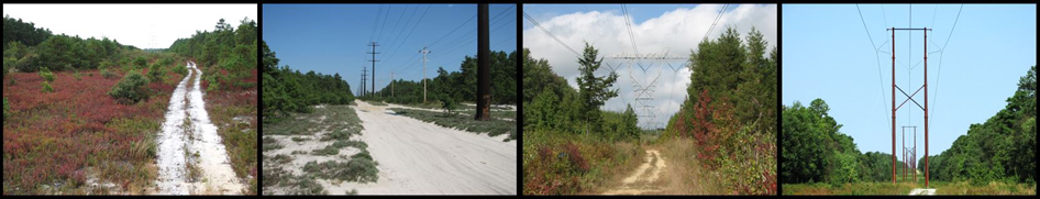
In 2006, the Pinelands Commission contracted with the Rutgers University Center for Remote Sensing and Spatial Analysis (CRSSA) to develop a vegetation-management plan for the bulk-electric-transmission rights-of-way in the Pinelands Area. Bulk-transmission lines have a 69 kV capacity or greater. These rights-of-way are managed by three utility companies, including Public Service Enterprise Group (PSEG), Jersey Central Power and Light (JCP&L), and Atlantic City Electric (ACE). The utility companies, along with the New Jersey Board of Public Utilities, were important partners in the project. The specific goal of the project was to develop a right-of-way vegetation-management plan to create and maintain relatively stable and sustainable, early successional habitats that reflect characteristic Pinelands habitats, require minimal management, ensure transmission reliability and safety, and minimize the need for individual Pinelands permit reviews. To accomplish this goal, a geographic-information system (GIS) database of bulk-electric-transmission rights-of-way was created, managed right-of-way and Pinelands-reference habitats were mapped, patch and landscape characteristics of managed right-of-way and Pinelands-reference habitats were compared, right-of-way vegetation-management strategies used by utility companies inside and outside the Pinelands were summarized, and a dynamic span-by-span vegetation-management plan was developed. The right-of-way plan includes a report (Lathrop and Bunnell 2009) that describes the methods and results of each project task and a GIS layer that includes specific vegetation-management prescriptions for each of the 3,041 spans that compose the 233 mi (2,695 ac) of Pinelands rights-of-way.
Two versions of the right-of-way GIS layer file are available for download. One file is for use with ArcMap version 9.2 (ArcMap file), which is proprietary GIS software, and the other file is for use with Google Earth version 5 (Google file). Google Earth is available at no charge and can be installed by following the instructions at the Google Earth download site. For Google Earth, download the software and the Google file from the links given above and double click on the file. This will open the right-of-way layer in Google Earth (Alternatively, start up Google Earth, select file, open and navigate to the downloaded Google file and select open). The right-of-way layer will be displayed on the map and will look like a series of connected rectangles. Each rectangle represents a span, or the area of right-of-way between adjacent transmission-line towers. Zoom in to the desired location and click the span or the white arrow to see the information associated with a span. Among other data, this information includes the span number (UNIQUE_ID), utility company (UTILITY), and the vegetation-management prescription (PRESCRIPTI).
Related Links


Pinelands Commission
15 Springfield Road
New Lisbon, NJ 08064
609-894-7300